


Containing more than 500 open datasets, GeoHub lets users access the wealth of data Los Angeles makes available. The tool is also intended to help employees from different city departments work together.
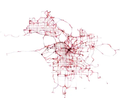
Early this year, the city of Los Angeles made public a new data visualization tool called GeoHub. Josh Cohen writes, "GeoHub is a searchable directory of over 500 eclectic L.A. city datasets such as farmers markets, emergency services, construction projects, streams and rivers, volunteer opportunities, crime, performing arts centers, and many more."
Catherine Geanuracos, a civic hacker and member of L.A.'s innovation and performance commison, remarked, "'When Mayor Garcetti took office, he started moving forward with open data. This is the next step on that from the city.'" Geanuracos went on, "The city of L.A. has been extremely siloed. Anything that prompts collaboration will be really valuable for the city overall, whether it's planning or evaluation."
L.A.'s deputy chief data officer Lillian Coral hopes GeoHub can be useful to an "engaged citizenry" of journalists, advocates, and others who may lack the time or technical acumen to decipher open data in its raw form.
FULL STORY: L.A. Opens Up More With New Data Tool

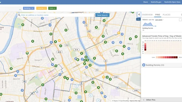
Presenting Municipal Data in an Interactive Map, Nashville Style
The city of Nashville launched the NashView interactive data map earlier this month.

DataUSA: An Intuitive Tool for Public Data
A collaboration between Deloitte, Datawheel, and MIT has produced an intuitive aesthetically-pleasing gathering point for public data in the United States. Specific locations and industries boast easy-to-read profiles.

Mapping the Age of Every Building in Los Angeles
Developed using open data from local government sources, built: LA is a mapping tool that displays the age of every building in the county. Much of the area's built environment is surprisingly old.

National Parks Layoffs Will Cause Communities to Lose Billions
Thousands of essential park workers were laid off this week, just before the busy spring break season.

Retro-silient?: America’s First “Eco-burb,” The Woodlands Turns 50
A master-planned community north of Houston offers lessons on green infrastructure and resilient design, but falls short of its founder’s lofty affordability and walkability goals.

Delivering for America Plan Will Downgrade Mail Service in at Least 49.5 Percent of Zip Codes
Republican and Democrat lawmakers criticize the plan for its disproportionate negative impact on rural communities.

Test News Post 1
This is a summary

Test News Headline 46
Test for the image on the front page.

Balancing Bombs and Butterflies: How the National Guard Protects a Rare Species
The National Guard at Fort Indiantown Gap uses GIS technology and land management strategies to balance military training with conservation efforts, ensuring the survival of the rare eastern regal fritillary butterfly.
Urban Design for Planners 1: Software Tools
This six-course series explores essential urban design concepts using open source software and equips planners with the tools they need to participate fully in the urban design process.
Planning for Universal Design
Learn the tools for implementing Universal Design in planning regulations.
EMC Planning Group, Inc.
Planetizen
Planetizen
Mpact (formerly Rail~Volution)
Great Falls Development Authority, Inc.
HUDs Office of Policy Development and Research
NYU Wagner Graduate School of Public Service