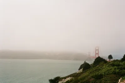
Designed by the same landscape architect behind New York City's High Line, a new park will cap San Francisco's Doyle Drive, connecting the Presidio to the shoreline.

Nestled just south of the Golden Gate Bridge, a new section of parkland will connect the Presidio to the water. Nate Berg writes, "The Doyle Drive replacement, completed in 2015, is tucked inside concrete tunnels, the roofs of which will serve as green bridges linking the two sections of the Presidio that were separated in the 1930s." The cap park heals a physical divide that became very acute after the Presidio ceased its service as a U.S. Army base in 1994.
According to James Corner, of James Corner Field Operations, "'When you step out on the tunnel tops, you really get a 360-degree, geographical sort of centering vantage point where you can take in every landmark and every place that's significant in San Francisco and the bay.'" Corner's firm also designed New York's High Line, which has received significant attention and praise.
Covering freeways with parkland is an idea that has become increasingly popular nationwide. "In Dallas, for example, the 5.2‑acre Klyde Warren Park opened in 2012 on a platform over a sunken section of freeway. Los Angeles and Seattle are now considering similar freeway-cap parks."
FULL STORY: San Francisco’s Plan to Bury a Freeway

National Parks Layoffs Will Cause Communities to Lose Billions
Thousands of essential park workers were laid off this week, just before the busy spring break season.

Retro-silient?: America’s First “Eco-burb,” The Woodlands Turns 50
A master-planned community north of Houston offers lessons on green infrastructure and resilient design, but falls short of its founder’s lofty affordability and walkability goals.

Delivering for America Plan Will Downgrade Mail Service in at Least 49.5 Percent of Zip Codes
Republican and Democrat lawmakers criticize the plan for its disproportionate negative impact on rural communities.

Test News Post 1
This is a summary

Test News Headline 46
Test for the image on the front page.

Balancing Bombs and Butterflies: How the National Guard Protects a Rare Species
The National Guard at Fort Indiantown Gap uses GIS technology and land management strategies to balance military training with conservation efforts, ensuring the survival of the rare eastern regal fritillary butterfly.
Urban Design for Planners 1: Software Tools
This six-course series explores essential urban design concepts using open source software and equips planners with the tools they need to participate fully in the urban design process.
Planning for Universal Design
Learn the tools for implementing Universal Design in planning regulations.
EMC Planning Group, Inc.
Planetizen
Planetizen
Mpact (formerly Rail~Volution)
Great Falls Development Authority, Inc.
HUDs Office of Policy Development and Research
NYU Wagner Graduate School of Public Service


