


In the 1950s, southern Orange County, California was a place of open hills, citrus groves, and scattered towns. The I-5 Freeway changed that, paving the way for today's subdivisions.
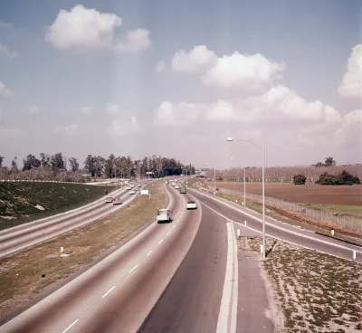
Running parallel to the coast through the heart of the county, the I-5 Freeway follows the path of the El Camino Real, a famed route from California's Spanish period. "If Orange County had a skeleton, the 5 freeway would be its spine. [...] No other piece of infrastructure so thoroughly binds together the spatial structure of Orange County."
Nathan Masters gives us photos and advertisements from the 1950s, when the freeway was extended past a sparkling new Disneyland, opening up the "Southland." Unlike some L.A. County freeways, the 5 didn't displace residents. "[...] for much of its length, construction crews paved over orange groves, bean fields, and cattle pastures rather than residential neighborhoods; when construction began, Orange County was a decidedly rural place, an agricultural landscape dotted by a few small towns, distinct from the Los Angeles metropolis."
"Its backbone in place, Orange County soon evolved from its rural, embryonic form (1950 population: 216,224) into the fully realized postmodern metropolis (2010 population: 3,010,232) we know today." The 5, also known as the Santa Ana Freeway, now runs the length of the country from Mexico to Canada.
FULL STORY: How the 5 Freeway Made Orange County Suburban

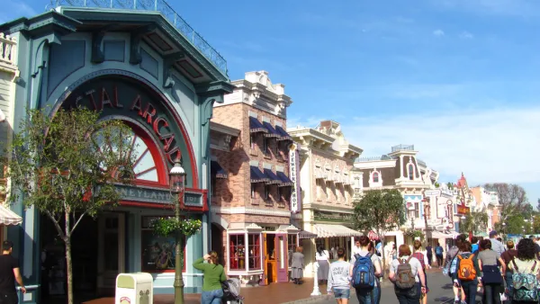
What Will Disneyland Be Like When it Reopens?
According to a study, Disneyland could comfortably accommodate 50% of the 110-acre theme park’s pre-COVID-19 attendance capacity.
Plans Advance for Orange County Streetcar
The $289 million streetcar would serve the cities of Santa Ana (population 329,00), county seat and second densest in California after San Francisco, and Garden Grove (population 170,000) on a 4.1-mile route. Service could begin 2020.
A Pedestrian's Perspective on Sprawling Orange County
Southern California's Orange County isn't exactly known for its walkability. Frank H. Wu decided to test that notion on a recent carless visit.

National Parks Layoffs Will Cause Communities to Lose Billions
Thousands of essential park workers were laid off this week, just before the busy spring break season.

Retro-silient?: America’s First “Eco-burb,” The Woodlands Turns 50
A master-planned community north of Houston offers lessons on green infrastructure and resilient design, but falls short of its founder’s lofty affordability and walkability goals.

Delivering for America Plan Will Downgrade Mail Service in at Least 49.5 Percent of Zip Codes
Republican and Democrat lawmakers criticize the plan for its disproportionate negative impact on rural communities.

Test News Post 1
This is a summary

Test News Headline 46
Test for the image on the front page.

Balancing Bombs and Butterflies: How the National Guard Protects a Rare Species
The National Guard at Fort Indiantown Gap uses GIS technology and land management strategies to balance military training with conservation efforts, ensuring the survival of the rare eastern regal fritillary butterfly.
Urban Design for Planners 1: Software Tools
This six-course series explores essential urban design concepts using open source software and equips planners with the tools they need to participate fully in the urban design process.
Planning for Universal Design
Learn the tools for implementing Universal Design in planning regulations.
EMC Planning Group, Inc.
Planetizen
Planetizen
Mpact (formerly Rail~Volution)
Great Falls Development Authority, Inc.
HUDs Office of Policy Development and Research
NYU Wagner Graduate School of Public Service