


A new map quantifies the stress levels for bike riders on the streets of Montgomery County, Maryland.

Just north of D.C., transportation planners in Montgomery County, Maryland have created a Bicycle Stress Map, reports Laura Bliss:
With a new Bicycle Stress Map, county planners have quantified and mapped the “traffic stress level” of the county’s bike network, assigning a numeric value and corresponding color to every street and bike trail.
Peter Furth, from Northeastern University, created the methodology for the stress map, calculating "TSL" values "based on traffic speed and volume, the number and width of car and bike lanes, parking turnover, how easy it is to get through intersections, and other characteristics," explains Bliss.
In addition to providing more detail about the methodology of the stress map, Bliss also analyzes the portrait of the Montgomery County bike network that emerges as a result. Among the most clear takeaways from the map: that the bicycle network is often most stressful around Metro stations and Capital Bikeshare stations.
FULL STORY: Mapping How Stressful Streets Can Limit Cycling

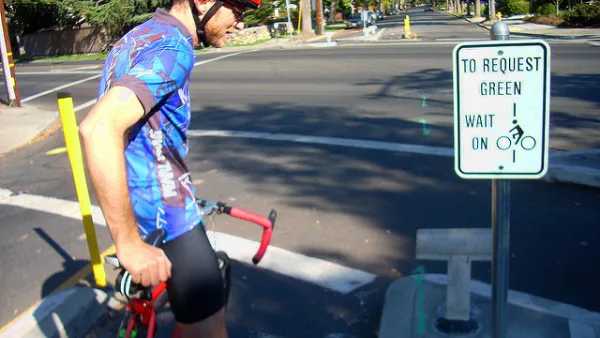
‘Idaho Stop’ Now Legal in Colorado
Colorado is the latest state to make it legal for people on bikes to treat stop signs like yield signs when no cars are in the intersection.

Colorado Legislature Approves 'Idaho Stop' Bill
Pending Gov. Polis's signature on a bill approved recently by the Colorado State Legislature, Colorado will become the latest state to allow people on bikes to yield at stop signs.

Pedestrian Planning in Response to Worsening Safety Data
Faced with rapidly deteriorating pedestrian safety statistics, Montgomery County in Maryland is getting to work on a new Pedestrian Plan, following closely on the heels of work completed for the county's Bicycle Master Plan.

Analysis: Cybertruck Fatality Rate Far Exceeds That of Ford Pinto
The Tesla Cybertruck was recalled seven times last year.

National Parks Layoffs Will Cause Communities to Lose Billions
Thousands of essential park workers were laid off this week, just before the busy spring break season.

Retro-silient?: America’s First “Eco-burb,” The Woodlands Turns 50
A master-planned community north of Houston offers lessons on green infrastructure and resilient design, but falls short of its founder’s lofty affordability and walkability goals.

Test News Post 1
This is a summary

Analysis: Cybertruck Fatality Rate Far Exceeds That of Ford Pinto
The Tesla Cybertruck was recalled seven times last year.

Test News Headline 46
Test for the image on the front page.
Urban Design for Planners 1: Software Tools
This six-course series explores essential urban design concepts using open source software and equips planners with the tools they need to participate fully in the urban design process.
Planning for Universal Design
Learn the tools for implementing Universal Design in planning regulations.
EMC Planning Group, Inc.
Planetizen
Planetizen
Mpact (formerly Rail~Volution)
Great Falls Development Authority, Inc.
HUDs Office of Policy Development and Research
NYU Wagner Graduate School of Public Service