


Part of a $380 million renovation project on the Gateway Arch grounds, a new riverfront path is built two feet higher above the banks of the mighty Mississippi River.
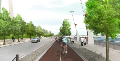
"The stretch of riverfront below the Gateway Arch should better withstand flooding after being raised about two feet, meaning fewer shutdowns when the Mississippi River rises in the area popular with tourists," reports Leah Thorsen.
The riverfront project is part of a $380 million restoration of the Gateway Arch grounds, including the rebuilt Leonor K. Sullivan Boulevard and a bike path along a 1.5-mile stretch from Chouteau Avenue to Biddle Street. "Other upgrades include new lighting, landscaping, benches and bike racks," adds Thorsen. Planetizen has been tracking the CityArchRiver project, as it's called, since its early conceptual stages in September 2010.
The flood control aspects of the project weigh prominently, however, as the city prepares to celebrate the opening of the new path today. Just this previous winter, the city of St. Louis saw widespread flooding, and construction of the Gateway Arch renovation project was shut down three times by flooding since construction commenced in December 2013. The rest of Gateway Arch grounds are expected to reopen this fall.
FULL STORY: Rebuilt and elevated Arch riverfront should mean less flooding

Five Plans for Reviving the St. Louis Gateway Arch Park
Five finalists have been announced in a design competition to rethink the park near St. Louis' iconic Gateway Arch. Fast Co. Design takes a look at the contenders.
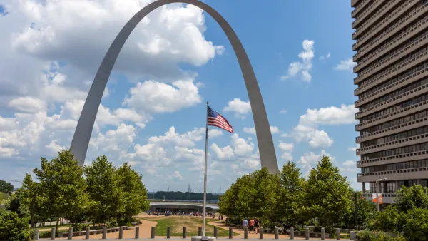
Newly Minted St. Louis Gateway Arch National Park Reviewed
The recently revitalized and designated as a National Park St. Louis Gateway Arch National Park is described by park planner Clement Lau.
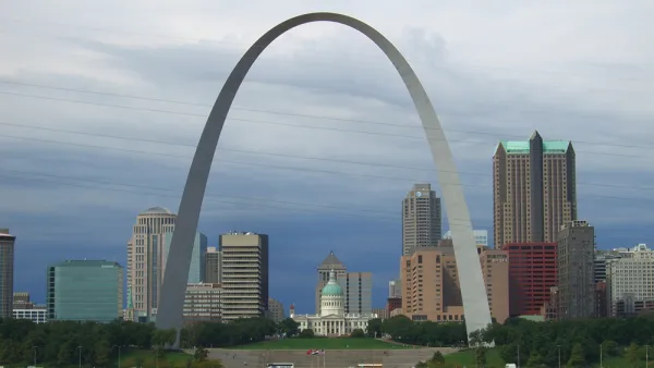
Design Review: Revamped Gateway Arch an Urban Success
Pulitzer Prize-winning critic Blair Kamin assesses the remodeled Gateway Arch in St. Louis, prior to its big public opening on July 3.

National Parks Layoffs Will Cause Communities to Lose Billions
Thousands of essential park workers were laid off this week, just before the busy spring break season.

Retro-silient?: America’s First “Eco-burb,” The Woodlands Turns 50
A master-planned community north of Houston offers lessons on green infrastructure and resilient design, but falls short of its founder’s lofty affordability and walkability goals.

Delivering for America Plan Will Downgrade Mail Service in at Least 49.5 Percent of Zip Codes
Republican and Democrat lawmakers criticize the plan for its disproportionate negative impact on rural communities.

Test News Post 1
This is a summary

Test News Headline 46
Test for the image on the front page.

Balancing Bombs and Butterflies: How the National Guard Protects a Rare Species
The National Guard at Fort Indiantown Gap uses GIS technology and land management strategies to balance military training with conservation efforts, ensuring the survival of the rare eastern regal fritillary butterfly.
Urban Design for Planners 1: Software Tools
This six-course series explores essential urban design concepts using open source software and equips planners with the tools they need to participate fully in the urban design process.
Planning for Universal Design
Learn the tools for implementing Universal Design in planning regulations.
EMC Planning Group, Inc.
Planetizen
Planetizen
Mpact (formerly Rail~Volution)
Great Falls Development Authority, Inc.
HUDs Office of Policy Development and Research
NYU Wagner Graduate School of Public Service