


Pop quiz: Can you recognize a major city based on an outline map?
Gretchen Peterson's City Maps: A Coloring Book for Adults provides maps of 44 major cities around the world for plannerds to color in to their heart's content.
But first things first: Can you identify those blank maps?
The Guardian challenges you to try with ten (pre-colored) images from the book, which is based on data from OpenStreetMap. The maps are pretty bare-bones—but a few iconic layouts are still instantly recognizable. Reward yourself with some coloring time for every guess you get right.
FULL STORY: Quiz: can you identify the city from the blank street map?


Pop Quiz: Can You Identify Cities By Density Alone?
A Planetizen editor failed this quiz.
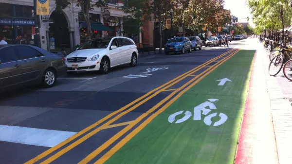
Pop Quiz: Name the City Based on its Cycle Lane Icon
The Guardian has a new pop quiz that will test the knowledge of urban aficionados that tend toward two-wheeled forms of transportation.

Friday Fun: Can You Name These City Skylines?
Pop quiz hotshot: can you name the city by looking at silhouettes of their skylines?

Analysis: Cybertruck Fatality Rate Far Exceeds That of Ford Pinto
The Tesla Cybertruck was recalled seven times last year.

National Parks Layoffs Will Cause Communities to Lose Billions
Thousands of essential park workers were laid off this week, just before the busy spring break season.

Retro-silient?: America’s First “Eco-burb,” The Woodlands Turns 50
A master-planned community north of Houston offers lessons on green infrastructure and resilient design, but falls short of its founder’s lofty affordability and walkability goals.

Test News Post 1
This is a summary

Analysis: Cybertruck Fatality Rate Far Exceeds That of Ford Pinto
The Tesla Cybertruck was recalled seven times last year.

Test News Headline 46
Test for the image on the front page.
Urban Design for Planners 1: Software Tools
This six-course series explores essential urban design concepts using open source software and equips planners with the tools they need to participate fully in the urban design process.
Planning for Universal Design
Learn the tools for implementing Universal Design in planning regulations.
EMC Planning Group, Inc.
Planetizen
Planetizen
Mpact (formerly Rail~Volution)
Great Falls Development Authority, Inc.
HUDs Office of Policy Development and Research
NYU Wagner Graduate School of Public Service