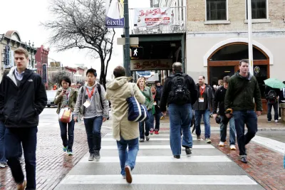
The Foot Traffic Ahead 2016 report, by Smart Growth America and The George Washington University’s Center for Real Estate & Urban Analysis ranks cities based on their walkability.

Smart Growth America released the Foot Traffic Ahead 2016 report this week, finding that "walkable urban places (WalkUPs) in all 30 of the largest metros are gaining market share over their drivable sub-urban competition—and showing substantially higher rental premiums."
Smart Growth America produced the report in conjunction with George Washington University’s Center for Real Estate & Urban Analysis, led by Christopher Leinberger and Michael Rodriguez.
According to a page announcing the report on the Smart Growth America website, the report ranks 30 metros "on the current percentage of occupied walkable urban office, retail, and multi-family rental square feet in their WalkUPs, compared to the balance of occupied square footage in the metro area." According to those metrics, New York City; Washington, D.C.; Boston; Chicago; San Francisco; and Seattle rank the highest, respectively.
David Alpert picked up on the news of the report for Greater Greater Washington, noting the positive performance of the Washington, D.C. area in the ranking. Among the notable findings of the report regarding the Washington, D.C. area, "the walkable development in jurisdictions outside the (or a) traditional center city. In the Washington region, half of the walkable urbanism is not inside DC, but in places like Silver Spring, Reston, and Old Town Alexandria."
FULL STORY: Foot Traffic Ahead 2016

National Parks Layoffs Will Cause Communities to Lose Billions
Thousands of essential park workers were laid off this week, just before the busy spring break season.

Retro-silient?: America’s First “Eco-burb,” The Woodlands Turns 50
A master-planned community north of Houston offers lessons on green infrastructure and resilient design, but falls short of its founder’s lofty affordability and walkability goals.

Delivering for America Plan Will Downgrade Mail Service in at Least 49.5 Percent of Zip Codes
Republican and Democrat lawmakers criticize the plan for its disproportionate negative impact on rural communities.

Test News Post 1
This is a summary

Test News Headline 46
Test for the image on the front page.

Balancing Bombs and Butterflies: How the National Guard Protects a Rare Species
The National Guard at Fort Indiantown Gap uses GIS technology and land management strategies to balance military training with conservation efforts, ensuring the survival of the rare eastern regal fritillary butterfly.
Urban Design for Planners 1: Software Tools
This six-course series explores essential urban design concepts using open source software and equips planners with the tools they need to participate fully in the urban design process.
Planning for Universal Design
Learn the tools for implementing Universal Design in planning regulations.
EMC Planning Group, Inc.
Planetizen
Planetizen
Mpact (formerly Rail~Volution)
Great Falls Development Authority, Inc.
HUDs Office of Policy Development and Research
NYU Wagner Graduate School of Public Service


