


An analysis of the geographic distribution of New York's new public plazas sought to determine if the program was meeting one of its stated goals: providing access to public plazas for low- and moderate-income households.
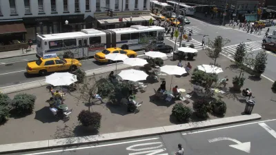
The NYC Plaza Program has set some lofty goals for the creation of new public spaces in the city. Writing in the Placemeter blog, Natalie Kunstadter took on the challenge of determining if the program is meeting one of its stated goals, by providing access to the new public plazas to households with low and moderate incomes. Using census data and location data for the new plazas provided by the city, Kunstadter's geospatial analysis looked at the proximity of target households to the plazas.
The Plaza Program wants to ensure that all New Yorkers are within a 10-minute walk of green space, so I analyzed the area within a 10-minute walk of each of the project sites. A quick internet search told me that a standard conversion for this walk was 800 meters, so I created an 800-meter buffer around each plaza. I then did a spatial join between the new polygons and the census/income polygons to find the average of the median household income that fell within a 10-minute walk of each plaza.
Kunstadter's analysis, detailed both in map and histogram form, found that approximately 54 percent of the new plazas were situated in areas that served low-income residents, meaning the program was achieving its stated goal for equal access. However she does seem room for improvement in the model, including giving weight to the population density in each tract. Better data analysis could potentially aid the program in placing future plazas in areas that need them.
[The article was updated with the correct spelling of the author's name.]
FULL STORY: Plazas For The People: A Geospatial Analysis Of The NYC Plaza Program


Even Parks Are Going Online During the Pandemic
Parks departments in New York City and Pittsburgh are offering videos and livestreams to cooped-up residents.
Frontlines of the Social Distancing Effort Shifts to Parks and Open Space
Too many people have been seeking normalcy on parks and on trails. This isn’t a normal time.
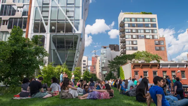
Ten Years of the High Line—Time to Reflect
As the High Line turns ten, a debate about the costs and benefits of urban revitalization continues.

Analysis: Cybertruck Fatality Rate Far Exceeds That of Ford Pinto
The Tesla Cybertruck was recalled seven times last year.

National Parks Layoffs Will Cause Communities to Lose Billions
Thousands of essential park workers were laid off this week, just before the busy spring break season.

Retro-silient?: America’s First “Eco-burb,” The Woodlands Turns 50
A master-planned community north of Houston offers lessons on green infrastructure and resilient design, but falls short of its founder’s lofty affordability and walkability goals.

Test News Post 1
This is a summary

Analysis: Cybertruck Fatality Rate Far Exceeds That of Ford Pinto
The Tesla Cybertruck was recalled seven times last year.

Test News Headline 46
Test for the image on the front page.
Urban Design for Planners 1: Software Tools
This six-course series explores essential urban design concepts using open source software and equips planners with the tools they need to participate fully in the urban design process.
Planning for Universal Design
Learn the tools for implementing Universal Design in planning regulations.
EMC Planning Group, Inc.
Planetizen
Planetizen
Mpact (formerly Rail~Volution)
Great Falls Development Authority, Inc.
HUDs Office of Policy Development and Research
NYU Wagner Graduate School of Public Service