


The U.S. Department of Transit has released its first ever National Transit Map.
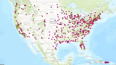
"The U.S. Department of Transportation’s Bureau of Transportation Statistics (BTS) today released National Transit Map data, a geospatial database containing the information submitted by almost 200 transit agencies that provides open, machine-readable data about their stops, routes, and schedules," according to a press release from BTS.
The national, openly available map of fixed-guideway and fixed-route transit service in America will allow the U.S. Department of Transportation (DOT) to demonstrate the importance and role of transit in American society and to identify and address gaps in access to public transportation. It will also support research, planning and analysis on the benefits of transit, such as the economic impacts of transit on a community’s economic development, or on reducing poverty in low-income neighborhoods.
Transportation Secretary Anthony Foxx also penned a blog post for the occasion, including a call for action to fill in some of the gaps in the map.
We have work still to do to ensure that each transit agency has this kind of data so we can make sure the Map represents all transit service. We're taking an iterative approach to building this important asset, and we are looking forward to demonstrating progress in future releases.
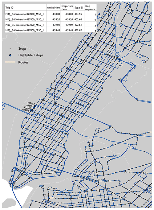
The idea for the National Transit Map was announced back in March, and between that time and now, the team behind the map gathered data from 270 transit agencies to map "nearky [sic] 400,000 stops and stations on nearly 10,000 routes."
FULL STORY: National Transit Map Data

U.S. DOT Making a National Transit Map
Transportation Secretary Antony Foxx called on local transit agencies earlier this month to share data to be used in building a comprehensive map of the nation's transit lines.
Transportation Secretary Foxx Wants to Go Out With a Bang
Governing profiles Transportation Secretary Anthony Foxx's ambitious goals to change the way the country thinks about transportation.
Financing of Hudson River Rail Tunnels in Peril
A funding agreement between New York, New Jersey, and the U.S. DOT for one of the most important rail projects in the nation is in danger of collapsing because of the way the two states are financing their share of the $12.9 billion cost.

Analysis: Cybertruck Fatality Rate Far Exceeds That of Ford Pinto
The Tesla Cybertruck was recalled seven times last year.

National Parks Layoffs Will Cause Communities to Lose Billions
Thousands of essential park workers were laid off this week, just before the busy spring break season.

Retro-silient?: America’s First “Eco-burb,” The Woodlands Turns 50
A master-planned community north of Houston offers lessons on green infrastructure and resilient design, but falls short of its founder’s lofty affordability and walkability goals.

Test News Post 1
This is a summary

Analysis: Cybertruck Fatality Rate Far Exceeds That of Ford Pinto
The Tesla Cybertruck was recalled seven times last year.

Test News Headline 46
Test for the image on the front page.
Urban Design for Planners 1: Software Tools
This six-course series explores essential urban design concepts using open source software and equips planners with the tools they need to participate fully in the urban design process.
Planning for Universal Design
Learn the tools for implementing Universal Design in planning regulations.
EMC Planning Group, Inc.
Planetizen
Planetizen
Mpact (formerly Rail~Volution)
Great Falls Development Authority, Inc.
HUDs Office of Policy Development and Research
NYU Wagner Graduate School of Public Service