


Community and Regional Planning Associate Professor Zhenghong Tang received an Environmental Protection Agency (EPA) grant to explore the use of drones to monitor wetlands.
What would happen if the wetland wildlife along the Platte River just vanished? No more sandhill cranes, no more geese, no more pheasants, no more ducks, no more hunting, no more bird watching, no more millions of dollars in annual Nebraska tourism.
That is the worst case scenario however Nebraska wetlands have indeed suffered some major habitat losses in the past and wildlife management officials and others are working hard to prevent such occurrences from happening again. Joining that effort is Community and Regional Planning Associate Professor Zhenghong Tang from the College of Architecture at University of Nebraska who has made wildlife conservation one of his career focuses. Most recently the Environmental Protection Agency (EPA) funded a three-year project of Tang’s entitled “Innovative Technology for Playa Wetland Monitoring and Assessment” with Tang serving as principal investigator and Wayne Woldt, Associate Professor of Biological Systems Engineering and Environmental Engineer from the School of Natural Resources as co-principal investigator.
Using an Unmanned Aircraft System (UAS), Tang and Woldt along with a research assistant and an UAS technician plan to develop a methodology for conducting dynamic monitoring and precise assessment of playa wetland habitat conditions. Areas the team plans to focus on include: hydrological conditions, vegetation and energy levels and wildlife usage in the Nebraska Rainwater Basin. Surveying the public waterfowl production and wildlife management areas across the basin will take the team multiple field trips to complete the data collection during each spring and fall migratory seasons.
During the UAS or drone flights, the team will be using multispectral sensors for detection of soil moisture levels and mapping of wetland inundation during spring migration season; thermal imaging cameras and oblique photogrammetry for evaluation of wildlife use and its distribution on playa wetlands; and 3-D imagery for surveys of plant community conditions, estimations of energy availability and assessments of vegetation management effectiveness.
The use of UAS is a huge improvement over the traditional large, plane or ground surveying method’s commonly used. This method will provide improved imaging with greater resolution and detail in a cost-efficient, timely and flexible manner. The new surveying tools and applicable protocols will offer wetland managers a greater understanding of wetland spring inundation conditions. If this method is proven to be effective, the methodology can be replicated elsewhere. Having this information for wildlife managers will have a significant impact on conservation efforts.
“Conducting timely monitoring and accurate assessment is extremely important for wetland managers to implement appropriate conservation programs to increase the quantity and quality of wetlands,” commented Jeff Drahota, U.S. Fish and Wildlife Service Biologist with the Rainwater Basin Wetland Management District. “This Unmanned Aircraft System provides an advanced new tool to conduct more rapid, precise monitoring and assessment for playa wetlands.”
In the past, environmental disruptions such as reduction in water flow because of upstream diversions, sediment, invasive species, and poor water quality have contributed to major losses in playa habitat. By keeping a closer eye on the situation, wildlife managers will be able to identify threats before they negatively influence the wetlands or reach a point that will be very costly and time intensive to restore. With successful adoption of the proposed methodologies, this project has the potential to transform reactive wildlife management to a proactive and efficient system.
The data analyzed during the assessment stage will help close the information gap and help wildlife managers implement proven restoration practices, choose more effective treatments and create a better understanding of this delicate ecosystem throughout its annual cycle.
“It is important to test and verify the innovative UAS methodology in wetland monitoring and assessment,” added Tang. “This project is a great first step to an exciting new way to conserve our wetlands.”
Tang has successfully managed several playa wetlands research projects that integrated data from the field surveys, satellite images and fixed-wing airplanes. Since 2010, he has had wetland research projects funded by the U.S. Fish and Wildlife Service, the Great Plains Landscape Conservation Cooperative, the United States Department of Interior, the United States Department of Agriculture, and four projects funded by the Environmental Protection Agency. The research findings have been published in Wetlands journal, Journal of the American Water Resources Association and International Journal of Geo-Information.
FULL STORY: EPA Awards Grant To Monitor Wetlands Using Unmanned Aircraft System


States Scramble in Wake of Clean Water Act Ruling
The removal of federal oversight of wetlands has left millions of acres unregulated and erected major hurdles for lawmakers seeking to protect them.

Shifts in Shopping: Transforming Malls Into Parks
Maybe zombie malls still have a second life — one with a little greenery.
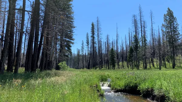
Yosemite Meadow Undergoing Major Restoration
Rangeland recently acquired from private owners is being restored to a more natural state thanks to a purchase by the Trust for Public Land.

Analysis: Cybertruck Fatality Rate Far Exceeds That of Ford Pinto
The Tesla Cybertruck was recalled seven times last year.

National Parks Layoffs Will Cause Communities to Lose Billions
Thousands of essential park workers were laid off this week, just before the busy spring break season.

Retro-silient?: America’s First “Eco-burb,” The Woodlands Turns 50
A master-planned community north of Houston offers lessons on green infrastructure and resilient design, but falls short of its founder’s lofty affordability and walkability goals.

Test News Post 1
This is a summary

Analysis: Cybertruck Fatality Rate Far Exceeds That of Ford Pinto
The Tesla Cybertruck was recalled seven times last year.

Test News Headline 46
Test for the image on the front page.
Urban Design for Planners 1: Software Tools
This six-course series explores essential urban design concepts using open source software and equips planners with the tools they need to participate fully in the urban design process.
Planning for Universal Design
Learn the tools for implementing Universal Design in planning regulations.
EMC Planning Group, Inc.
Planetizen
Planetizen
Mpact (formerly Rail~Volution)
Great Falls Development Authority, Inc.
HUDs Office of Policy Development and Research
NYU Wagner Graduate School of Public Service