


New York's lack of sunlight might be overstated, but the New York Times mapped the shadows cast by every building on every block of the city just to be sure.

The New York Times has produced a series of artful maps that illustrates "all of the shadows produced by thousands of buildings in New York City over the course of one day."
Quoctrung Bui and Jeremy White provide the context for the maps, noting that in most parts of America, "sunlight is not debated the way it is in New York, where the city’s thirst for living space, working space and economic growth has turned the sun into a virtual commodity."
Planning, and specifically zoning, has been at the center of the debate for decades, according to the article.
The city’s first attempt at light preservation was through a setback rule. As successive buildings grew taller, they would have to be continually set back a couple of feet from the street (like the Empire State Building), producing the classic wedding-cake style of skyscraper. Decades later, in the 1960s, the city overhauled this rule in favor of a floor-area ratio model, which tended to produce tall, narrow structures with open plazas at the base (like the Seagram Building).
The article includes three maps, presenting the variations between the seasons.
FULL STORY: Mapping the Shadows of New York City: Every Building, Every Block


Friday Eye Candy: A Sorely-Needed Map of New York City Neighborhoods
Neighborhoods don't get the same official boundaries as cities, counties, states, and countries. So how do we know where one neighborhood ends and another begins?

Friday Eye Candy: The Theatricality of the Subway
A new book of photography amplifies what was already there.
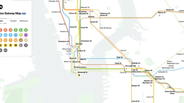
The New New York Subway Map Works in Real Time
There's a new chapter, and maybe an end, for the "Great Subway Map Debate."

National Parks Layoffs Will Cause Communities to Lose Billions
Thousands of essential park workers were laid off this week, just before the busy spring break season.

Retro-silient?: America’s First “Eco-burb,” The Woodlands Turns 50
A master-planned community north of Houston offers lessons on green infrastructure and resilient design, but falls short of its founder’s lofty affordability and walkability goals.

Delivering for America Plan Will Downgrade Mail Service in at Least 49.5 Percent of Zip Codes
Republican and Democrat lawmakers criticize the plan for its disproportionate negative impact on rural communities.

Test News Post 1
This is a summary

Test News Headline 46
Test for the image on the front page.

Balancing Bombs and Butterflies: How the National Guard Protects a Rare Species
The National Guard at Fort Indiantown Gap uses GIS technology and land management strategies to balance military training with conservation efforts, ensuring the survival of the rare eastern regal fritillary butterfly.
Urban Design for Planners 1: Software Tools
This six-course series explores essential urban design concepts using open source software and equips planners with the tools they need to participate fully in the urban design process.
Planning for Universal Design
Learn the tools for implementing Universal Design in planning regulations.
EMC Planning Group, Inc.
Planetizen
Planetizen
Mpact (formerly Rail~Volution)
Great Falls Development Authority, Inc.
HUDs Office of Policy Development and Research
NYU Wagner Graduate School of Public Service