


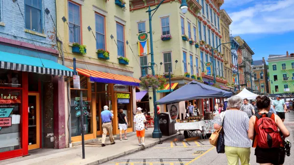
Researchers at MIT and Harvard believe that their computer vision system (i.e., artificial intelligence) helps reveal fundamental characteristics of neighborhood change.
Larry Hardesty shares news of a new "computer vision system" from MIT's Media Lab, created with partners from Harvard University, that quantifies "the physical improvement or deterioration of neighborhoods in five American cities."
In work reported today in the Proceedings of the National Academy of Sciences, the system compared 1.6 million pairs of photos taken seven years apart. The researchers used the results of those comparisons to test several hypotheses popular in the social sciences about the causes of urban revitalization. They find that density of highly educated residents, proximity to central business districts and other physically attractive neighborhoods, and the initial safety score assigned by the system all correlate strongly with improvements in physical condition.
The new tool is built on a system created four years ago, which analyzes "street-level photos taken in urban neighborhoods in order to gauge how safe the neighborhoods would appear to human observers."
Hardesty goes into a lot more detail about the ideas that contributed to the creation of the computer vision system, and the findings that have been produced in its deployment.
Linda Poon offers additional insight into the use of artificial intelligence in the analysis of urban conditions.
FULL STORY: Why do some neighborhoods improve?

Black Residents Leaving Cincinnati's Fast Growing Urban Area
The housing market in the neighborhood of Over-the-Rhine is a 'segregation machine.'

$160 Million in Bond Funding for Demolitions on the Ballot in Detroit
Proposal N, on the ballot for Detroit voters next week, will provide $160 million in bond funding for demolitions and $90 million to mothball homes for future rehab, but, according to this opinion, it won't solve the city's blight challenges.

Revitalization Without Displacement: A New Model From Miami
Upzonings in working class neighborhoods usually provoke political opposition based on concerns about gentrification and displacement. But the new Wynwood Norte Neighborhood Revitalization District in Miami might have worked for a solution.

National Parks Layoffs Will Cause Communities to Lose Billions
Thousands of essential park workers were laid off this week, just before the busy spring break season.

Retro-silient?: America’s First “Eco-burb,” The Woodlands Turns 50
A master-planned community north of Houston offers lessons on green infrastructure and resilient design, but falls short of its founder’s lofty affordability and walkability goals.

Delivering for America Plan Will Downgrade Mail Service in at Least 49.5 Percent of Zip Codes
Republican and Democrat lawmakers criticize the plan for its disproportionate negative impact on rural communities.

Test News Post 1
This is a summary

Test News Headline 46
Test for the image on the front page.

Balancing Bombs and Butterflies: How the National Guard Protects a Rare Species
The National Guard at Fort Indiantown Gap uses GIS technology and land management strategies to balance military training with conservation efforts, ensuring the survival of the rare eastern regal fritillary butterfly.
Urban Design for Planners 1: Software Tools
This six-course series explores essential urban design concepts using open source software and equips planners with the tools they need to participate fully in the urban design process.
Planning for Universal Design
Learn the tools for implementing Universal Design in planning regulations.
EMC Planning Group, Inc.
Planetizen
Planetizen
Mpact (formerly Rail~Volution)
Great Falls Development Authority, Inc.
HUDs Office of Policy Development and Research
NYU Wagner Graduate School of Public Service