


Changes to the BRTData.org criteria means fewer systems and corridors are considered to bus rapid transit.
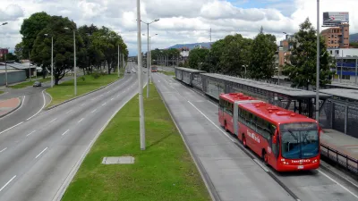
Paula Tanscheit and Virginia Tavares report that BRTData.org, the most comprehensive online database of bus rapid transit in the world, has updated its criteria to "align its corridor definition with the benchmarks and quality standards established by the Institute for Transportation and Development Policy." As BRTData.org has grown, "a need to establish stricter quality standards has become apparent," according to the article. The hope in making the change is also to do a better job evaluating quality of service.
Following their recommendations, from now on, BRT corridors will be defined as one or more contiguous lanes served by one or multiple bus lines with a minimum length of three kilometers that has segregated or exclusive bus lanes. If the segregated lane is aligned to the curb, at least one of the following elements must be present: (1) prepayment of the tariff; (2) priority traffic signaling; (3) a boarding level or (4) a unique brand and logo.
Those changes mean 96 systems and corridors previously in the database are no longer included, although the post stops short of calling them out by name.
FULL STORY: BRTData Enhances Indicators to Improve Accuracy and Comparisons


Indianapolis Receives FTA Grant for New BRT Line
The Blue Line will be the third bus rapid transit corridor in the city.
Central Ohio Voters Pass Transit Levy
The new sales tax will fund improved bus service, rapid transit projects, and ‘transit -supportive’ infrastructure.
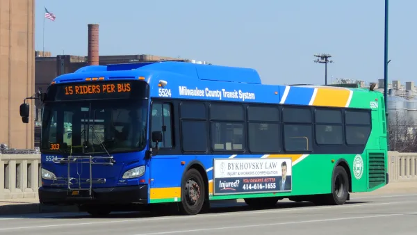
Postponed Milwaukee BRT Project at Least a Decade Away
The county’s transit system won’t pursue a second rapid bus line due to financial constraints.

National Parks Layoffs Will Cause Communities to Lose Billions
Thousands of essential park workers were laid off this week, just before the busy spring break season.

Retro-silient?: America’s First “Eco-burb,” The Woodlands Turns 50
A master-planned community north of Houston offers lessons on green infrastructure and resilient design, but falls short of its founder’s lofty affordability and walkability goals.

Delivering for America Plan Will Downgrade Mail Service in at Least 49.5 Percent of Zip Codes
Republican and Democrat lawmakers criticize the plan for its disproportionate negative impact on rural communities.

Test News Post 1
This is a summary

Test News Headline 46
Test for the image on the front page.

Balancing Bombs and Butterflies: How the National Guard Protects a Rare Species
The National Guard at Fort Indiantown Gap uses GIS technology and land management strategies to balance military training with conservation efforts, ensuring the survival of the rare eastern regal fritillary butterfly.
Urban Design for Planners 1: Software Tools
This six-course series explores essential urban design concepts using open source software and equips planners with the tools they need to participate fully in the urban design process.
Planning for Universal Design
Learn the tools for implementing Universal Design in planning regulations.
EMC Planning Group, Inc.
Planetizen
Planetizen
Mpact (formerly Rail~Volution)
Great Falls Development Authority, Inc.
HUDs Office of Policy Development and Research
NYU Wagner Graduate School of Public Service