


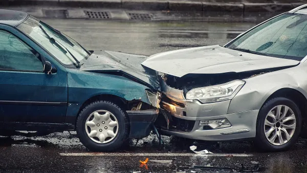
A downward trend in deaths from car crashes reversed sharply in 2015. Many blamed cell phones and the distractions they can cause, but a recent study complicates that hypothesis.

A study investigating deaths from car crashes found a correlation between warmer weather, vehicle miles traveled (VMT), and, ultimately, deaths on the road. Conducted by Dr. Leon Robertson, formerly of Yale University, the study found that 2015 was a particularly warm year in the U.S. and suggests this might be why it was such a deadly year on the streets. "Road deaths in the U.S. jumped 7 percent in 2015, to 35,200 — an abrupt reversal of the downward trend that has persisted for the previous 35 years," Susan Perry writes in the Minneapolis Post.
Robertson undertook the study in part because he was not convinced by the hypothesis that the jump in deaths was attributable to distracted drivers with cell phones. Robertson points out that by 2014 cellphones were already ubiquitous in the U.S.
"[Robertson] found that for each degree increase in temperature, vehicles were driven an average of 60 extra miles per person per year. He also found that for each additional inch of rainfall, vehicles were driven an extra 66 miles per person," Perry reports. Still, this study can only show correlation (not causation) between weather and driving, especially since the participants were not surveyed.
FULL STORY: Warmer temperatures, not cell phone use, was behind recent spike in road deaths, researcher says

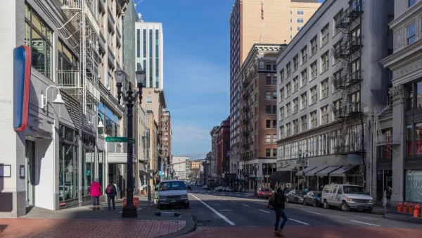
The Geography of Fatal Car Crashes
Where do the most traffic deaths happen?
Portland Traffic Deaths Surpass 2022 Number
This year, 69 people have died in traffic crashes in Portland, Oregon, nearly twice as many as in 2018, when the city began its Vision Zero program.
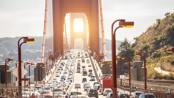
San Francisco ‘Best-Performing Metro’ for VMT, Traffic Reduction
The city saw a 13 percent drop in miles driven per capita in the last five years.

National Parks Layoffs Will Cause Communities to Lose Billions
Thousands of essential park workers were laid off this week, just before the busy spring break season.

Retro-silient?: America’s First “Eco-burb,” The Woodlands Turns 50
A master-planned community north of Houston offers lessons on green infrastructure and resilient design, but falls short of its founder’s lofty affordability and walkability goals.

Delivering for America Plan Will Downgrade Mail Service in at Least 49.5 Percent of Zip Codes
Republican and Democrat lawmakers criticize the plan for its disproportionate negative impact on rural communities.

Test News Post 1
This is a summary

Test News Headline 46
Test for the image on the front page.

Balancing Bombs and Butterflies: How the National Guard Protects a Rare Species
The National Guard at Fort Indiantown Gap uses GIS technology and land management strategies to balance military training with conservation efforts, ensuring the survival of the rare eastern regal fritillary butterfly.
Urban Design for Planners 1: Software Tools
This six-course series explores essential urban design concepts using open source software and equips planners with the tools they need to participate fully in the urban design process.
Planning for Universal Design
Learn the tools for implementing Universal Design in planning regulations.
EMC Planning Group, Inc.
Planetizen
Planetizen
Mpact (formerly Rail~Volution)
Great Falls Development Authority, Inc.
HUDs Office of Policy Development and Research
NYU Wagner Graduate School of Public Service