


The Transportation Planning Organization will budget a study on how best to connect trails to transit hubs.

Miami's Transportation Planning Organization is looking at how to connect biking and walking infrastructure with its public transit. The Strategic Miami Area Rapid Transit or SMART plan, is looking at how to improve or connect a number of different trails like "…the Underline, a 10-mile linear park and urban trail below the Metrorail running from the Miami River north of the Brickell Metrorail station to the Dadeland Metrorail station; the 6.2-mile multi-use Ludlam Trail running parallel to and west of Ludlam Road from near Northwest Seventh to Southwest 80th streets; and the Miami River Greenway, a public pathway running about 5.5 miles on both sides of the river west from Biscayne Bay toward Miami International Airport," Jesse Scheckner reports for Miami Today.
The Transport Planning Organization has just purchased a former railroad line, "they unanimously green-lighted the purchase of the Ludlam Trail from Brightline owner Florida East Coast Industries, whose discontinued railroad corridor comprises the six-mile linear greenway," Scheckner writes. The development of that trail would connect bikers to two transit hubs, numerous schools, businesses and residences.

Transit Debate Coming to a Head Soon in Miami-Dade
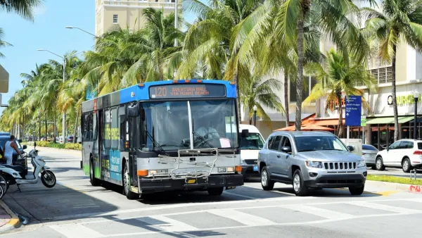
A new network of buses, designed with the bus priority features, has been proposed in Miami. The catch: it would come at the expense of a promised rail extension program.

Visualizing Transit Reliability (Or Not)
A new tool in Miami could use broader application in cities around the country (hint hint).
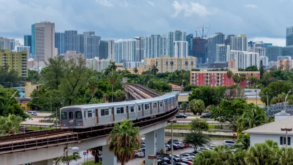
Miami Doubling Down On Rapid Transit
Autonomous vehicles replacing fixed transit may be on the minds of many in the transportation world, but that's not stopping cities from upgrading and building around their transit lines.

National Parks Layoffs Will Cause Communities to Lose Billions
Thousands of essential park workers were laid off this week, just before the busy spring break season.

Retro-silient?: America’s First “Eco-burb,” The Woodlands Turns 50
A master-planned community north of Houston offers lessons on green infrastructure and resilient design, but falls short of its founder’s lofty affordability and walkability goals.

Delivering for America Plan Will Downgrade Mail Service in at Least 49.5 Percent of Zip Codes
Republican and Democrat lawmakers criticize the plan for its disproportionate negative impact on rural communities.

Test News Post 1
This is a summary

Test News Headline 46
Test for the image on the front page.

Balancing Bombs and Butterflies: How the National Guard Protects a Rare Species
The National Guard at Fort Indiantown Gap uses GIS technology and land management strategies to balance military training with conservation efforts, ensuring the survival of the rare eastern regal fritillary butterfly.
Urban Design for Planners 1: Software Tools
This six-course series explores essential urban design concepts using open source software and equips planners with the tools they need to participate fully in the urban design process.
Planning for Universal Design
Learn the tools for implementing Universal Design in planning regulations.
EMC Planning Group, Inc.
Planetizen
Planetizen
Mpact (formerly Rail~Volution)
Great Falls Development Authority, Inc.
HUDs Office of Policy Development and Research
NYU Wagner Graduate School of Public Service