


Ever wonder how maps were made in the decades before vector-based graphics software like Adobe Illustrator were invented? The Atlantic has posted a film from the 1940's that documents the process of "Modern Map Making."
"Caught Mapping, produced by Chevrolet in 1940, explores how roadmaps were made at the time. Courtesy of the Prelinger Archive, the educational film outlines the whole process, from the field men who do the research to the cartographers who update the maps, featuring strategically placed Chevrolet cars all along the way," writes Kasia Cieplak-Mayr von Baldegg.
FULL STORY: A Vintage Look at 'Modern Map Making' in the 1940s


New Book Shows How Geographic Technology Tackles Global Challenges
In his new book, Jack Dangermond explores the transformative impact of GIS technology in solving global challenges through spatial data, highlighting its widespread application across sectors and its potential to design sustainable futures.

Building Healthier Communities: The Role of GIS in Park Planning
Integrating Geographic Information Systems (GIS) into park planning enhances community health by promoting physical activity, supporting mental well-being, fostering social connectedness, and addressing public health crises and climate change.
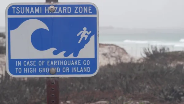
Washington State Requests Federal Funding for Tsunami Preparedness
The state’s Department of Natural Resources says it needs continued funding to map coastal areas at risk for tsunami impacts and prepare mitigation and evacuation plans.

Analysis: Cybertruck Fatality Rate Far Exceeds That of Ford Pinto
The Tesla Cybertruck was recalled seven times last year.

National Parks Layoffs Will Cause Communities to Lose Billions
Thousands of essential park workers were laid off this week, just before the busy spring break season.

Retro-silient?: America’s First “Eco-burb,” The Woodlands Turns 50
A master-planned community north of Houston offers lessons on green infrastructure and resilient design, but falls short of its founder’s lofty affordability and walkability goals.

Test News Post 1
This is a summary

Analysis: Cybertruck Fatality Rate Far Exceeds That of Ford Pinto
The Tesla Cybertruck was recalled seven times last year.

Test News Headline 46
Test for the image on the front page.
Urban Design for Planners 1: Software Tools
This six-course series explores essential urban design concepts using open source software and equips planners with the tools they need to participate fully in the urban design process.
Planning for Universal Design
Learn the tools for implementing Universal Design in planning regulations.
EMC Planning Group, Inc.
Planetizen
Planetizen
Mpact (formerly Rail~Volution)
Great Falls Development Authority, Inc.
HUDs Office of Policy Development and Research
NYU Wagner Graduate School of Public Service