


A plan that would change zoning along a key stretch of Marshall Avenue in St. Paul has been called both an upzoning and a downzoning. It's got a little bit of both.
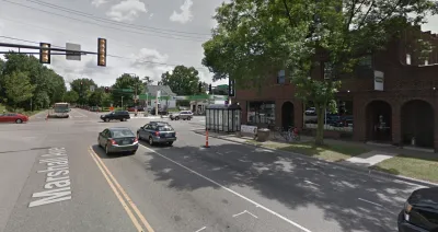
"Over the past year, the city of St. Paul has studied possible zoning changes along 22 blocks — a two-mile stretch — of Marshall between Mississippi River Boulevard and Hamline Avenue, which could someday be connected by a possible bus rapid transit route," reports Frederick Melo.
"The proposed changes would allow more housing density than is currently permissible along several key intersections, including stretches of Marshall south of the Town & Country Club and east of Snelling Avenue," adds Melo. "It would also allow much less density than currently permitted within many residential blocks that are dotted by century-old houses but, to the surprise of many homeowners, were found to have been zoned for decades for five-story buildings."
The plan recently passed, by a close vote, through the planning commission. The City Council will vote on the project on September 26. Melo provides more details of the plan, and the political debate surrounding the plan, in the article.
FULL STORY: St. Paul considers more density — and much less — along Marshall Avenue


Pittsburgh Moves Ahead With Zoning Changes for University-Adjacent Neighborhood
The implementation of a new master plan for the neighborhood of Oakland, home to the University of Pittsburgh, is moving forward despite controversy and a contentious community engagement process.
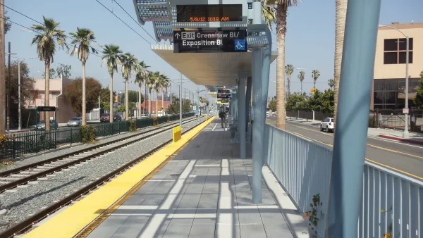
Inglewood Set to Rezone Neighborhoods Near New Transit Lines
Plans for the area include thousands of new housing units, public parks, and improved bike and pedestrian infrastructure.

Mayoral Veto Kills Controversial Philadelphia Downzoning
The mayor, planning staff, and the Philadelphia Planning Commission agree. The Philadelphia City Council and residents of the wealthy neighborhood of Society Hill, not so much.

National Parks Layoffs Will Cause Communities to Lose Billions
Thousands of essential park workers were laid off this week, just before the busy spring break season.

Retro-silient?: America’s First “Eco-burb,” The Woodlands Turns 50
A master-planned community north of Houston offers lessons on green infrastructure and resilient design, but falls short of its founder’s lofty affordability and walkability goals.

Delivering for America Plan Will Downgrade Mail Service in at Least 49.5 Percent of Zip Codes
Republican and Democrat lawmakers criticize the plan for its disproportionate negative impact on rural communities.

Test News Post 1
This is a summary

Test News Headline 46
Test for the image on the front page.

Balancing Bombs and Butterflies: How the National Guard Protects a Rare Species
The National Guard at Fort Indiantown Gap uses GIS technology and land management strategies to balance military training with conservation efforts, ensuring the survival of the rare eastern regal fritillary butterfly.
Urban Design for Planners 1: Software Tools
This six-course series explores essential urban design concepts using open source software and equips planners with the tools they need to participate fully in the urban design process.
Planning for Universal Design
Learn the tools for implementing Universal Design in planning regulations.
EMC Planning Group, Inc.
Planetizen
Planetizen
Mpact (formerly Rail~Volution)
Great Falls Development Authority, Inc.
HUDs Office of Policy Development and Research
NYU Wagner Graduate School of Public Service