


A wealth of pre-authored policy maps lets users access data to explore public policy issues.
The Esri Maps for Public Policy app allows users to quickly and easily put together maps by customizing existing Esri maps. "The app gives users ready-to-use location intelligence and express access to policy maps, so they can skip the steps of obtaining and preparing the data," writes Karisa Schroeder.
The app maps are based on the ArcGIS Living Atlas of the World collection of data, which is constantly updated. Esri Maps for Public Policy users select a location at the local, state, or national level and a topic and then have the option to add data from any of 400 available maps.
"The app includes data on social equity and health, economic opportunity, transportation and infrastructure, resilience and sustainability, the environment and natural resources, and public safety," notes Schroder. Esri is encouraging policymakers and citizens to use the app to help them as they face challenges in their communities around issues such as public health, affordable housing, and mobility.
FULL STORY: Mapping for Community Impact


Esri Sets Up COVID-19 GIS Hub
The planning profession can contribute to the worldwide fight to control the spread of COVID-19. GIS technology, for instance, allows real-time monitoring of the pandemic.

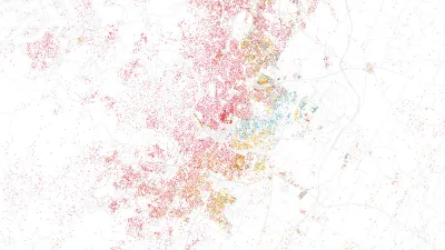
Mapping All the Land Uses in the Lower 48
A massive data visualization project illuminates the land uses that define the United States.

Who's Mapping Gentrification, and Where?
In these cities, data on gentrification has been compiled to build mapping tools documenting the process. The hope is to identify neighborhoods where low-income residents are at risk of displacement.

National Parks Layoffs Will Cause Communities to Lose Billions
Thousands of essential park workers were laid off this week, just before the busy spring break season.

Retro-silient?: America’s First “Eco-burb,” The Woodlands Turns 50
A master-planned community north of Houston offers lessons on green infrastructure and resilient design, but falls short of its founder’s lofty affordability and walkability goals.

Delivering for America Plan Will Downgrade Mail Service in at Least 49.5 Percent of Zip Codes
Republican and Democrat lawmakers criticize the plan for its disproportionate negative impact on rural communities.

Test News Post 1
This is a summary

Test News Headline 46
Test for the image on the front page.

Balancing Bombs and Butterflies: How the National Guard Protects a Rare Species
The National Guard at Fort Indiantown Gap uses GIS technology and land management strategies to balance military training with conservation efforts, ensuring the survival of the rare eastern regal fritillary butterfly.
Urban Design for Planners 1: Software Tools
This six-course series explores essential urban design concepts using open source software and equips planners with the tools they need to participate fully in the urban design process.
Planning for Universal Design
Learn the tools for implementing Universal Design in planning regulations.
EMC Planning Group, Inc.
Planetizen
Planetizen
Mpact (formerly Rail~Volution)
Great Falls Development Authority, Inc.
HUDs Office of Policy Development and Research
NYU Wagner Graduate School of Public Service