


According to a newly released working paper, people in 20th century noticed the air and noise pollution and severed neighborhoods caused by freeways, and many of those people chose to move to the suburbs rather than deal with the nuisance.
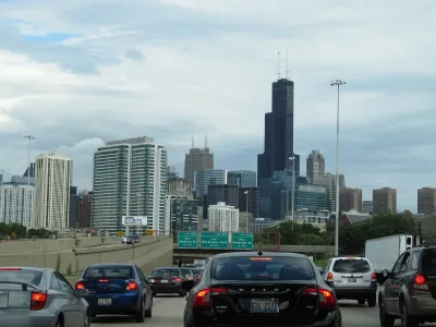
The Federal Reserve Bank of Philadelphia released a working paper [pdf] recently that documents the detrimental effects of freeways on quality of life in central urban areas.
As explained in an article by Darryl C. Murphy, researchers at the Federal Reserve Bank of Philadelphia "took a broad look at how highways have contributed to suburbanization, and the subsequent decline of U.S. cities during the 20th century. "
"They found that between 1950 and 2010 highways slowed growth in income, population, and land values in city centers, while having the opposite effect in outlying areas," according to Murphy.
A key aspect of the narrative built in the paper is the history of "freeway revolts"—communities banding together to sway the final product of the Interstate highway system where it passed through urban areas. The study documents the changes these revolts were able to produce in the final freeway products of urban areas.
Despite the location of the authors who wrote this working paper, the research focuses specifically on examples from Boston, Chicago, and Detroit.
FULL STORY: Philly Fed economists: Here’s how highways ruined your city

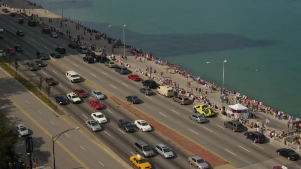
Bus Lanes, Desired by Advocates for Chicago's Lake Shore Drive Project, Back on the Table
After releasing a list of project alternatives that didn't include new bus lanes in the existing roadway, the Illinois Department of Transportation (IDOT) has changed its mind.
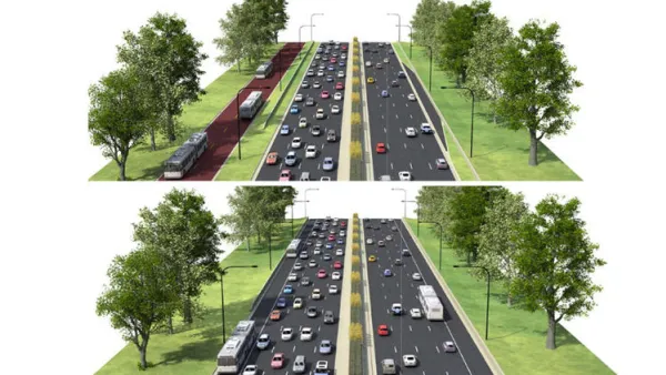
North Lake Shore Drive Redo Falls Short of Bus Priority Expectations
Strong criticisms of the project alternatives under consideration by the Illinois Department of Transportation for the closely watched North Lake Shore Drive project.
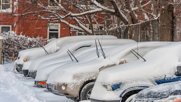
Research Quantifies the High Price of the Massachusetts Car Economy
Car culture isn't free, even for people who don't own cars.

National Parks Layoffs Will Cause Communities to Lose Billions
Thousands of essential park workers were laid off this week, just before the busy spring break season.

Retro-silient?: America’s First “Eco-burb,” The Woodlands Turns 50
A master-planned community north of Houston offers lessons on green infrastructure and resilient design, but falls short of its founder’s lofty affordability and walkability goals.

Delivering for America Plan Will Downgrade Mail Service in at Least 49.5 Percent of Zip Codes
Republican and Democrat lawmakers criticize the plan for its disproportionate negative impact on rural communities.

Test News Post 1
This is a summary

Test News Headline 46
Test for the image on the front page.

Balancing Bombs and Butterflies: How the National Guard Protects a Rare Species
The National Guard at Fort Indiantown Gap uses GIS technology and land management strategies to balance military training with conservation efforts, ensuring the survival of the rare eastern regal fritillary butterfly.
Urban Design for Planners 1: Software Tools
This six-course series explores essential urban design concepts using open source software and equips planners with the tools they need to participate fully in the urban design process.
Planning for Universal Design
Learn the tools for implementing Universal Design in planning regulations.
EMC Planning Group, Inc.
Planetizen
Planetizen
Mpact (formerly Rail~Volution)
Great Falls Development Authority, Inc.
HUDs Office of Policy Development and Research
NYU Wagner Graduate School of Public Service