


Augmented reality could boost safety for pedestrians, or it could add another layer of distraction between people and the real world.
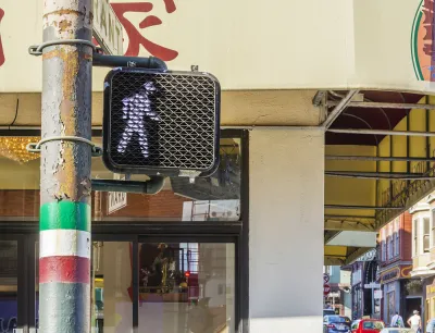
"Google Maps released an augmented reality (AR) feature, Live View, to help pedestrians navigate more effectively," reports Katie Pyzyk.
"The feature overlays a live video feed on the map. Directional arrows and street names appear on the video feed to provide more intuitive navigation and give the user a sense of exactly where they are and where they need to go.'
The new feature is intended to become a permanent element of Google Maps, according to a Google spokesperson quoted in the article. The article has more details about the availability of the new feature (locations and devices), as well as the potential benefits and risks of AR features used in the public realm.
Augmented reality is making steady progress into the mainstream app world. An AR public art app was released by Apple over the weekend in six cities.
FULL STORY: Google Maps releases AR feature for walking directions

Earn Rewards for Traveling for by Foot, Bike, Bus, or Train
The city of Orlando is partnering with the Miles app.

New Google Map Layer Shows COVID-19 Infection Rates
A new layer showing the seven-day average of confirmed COVID-19 cases started rolling out to Android and iPhones last week.

Southeast LA Road Safety Advocates Call for Improved Infrastructure
Streets in southeastern Los Angeles County have a severe lack of protected bike lanes and traffic safety measures, leading to high numbers of fatalities in a community where many residents depend on walking and biking for daily needs.

National Parks Layoffs Will Cause Communities to Lose Billions
Thousands of essential park workers were laid off this week, just before the busy spring break season.

Retro-silient?: America’s First “Eco-burb,” The Woodlands Turns 50
A master-planned community north of Houston offers lessons on green infrastructure and resilient design, but falls short of its founder’s lofty affordability and walkability goals.

Delivering for America Plan Will Downgrade Mail Service in at Least 49.5 Percent of Zip Codes
Republican and Democrat lawmakers criticize the plan for its disproportionate negative impact on rural communities.

Test News Post 1
This is a summary

Test News Headline 46
Test for the image on the front page.

Balancing Bombs and Butterflies: How the National Guard Protects a Rare Species
The National Guard at Fort Indiantown Gap uses GIS technology and land management strategies to balance military training with conservation efforts, ensuring the survival of the rare eastern regal fritillary butterfly.
Urban Design for Planners 1: Software Tools
This six-course series explores essential urban design concepts using open source software and equips planners with the tools they need to participate fully in the urban design process.
Planning for Universal Design
Learn the tools for implementing Universal Design in planning regulations.
EMC Planning Group, Inc.
Planetizen
Planetizen
Mpact (formerly Rail~Volution)
Great Falls Development Authority, Inc.
HUDs Office of Policy Development and Research
NYU Wagner Graduate School of Public Service