


A controversial proposed housing development in Newark exemplifies the struggle between increasing housing supply and protecting vulnerable shoreline communities from flooding.
(NRCS_Photo_Gallery).jpg)
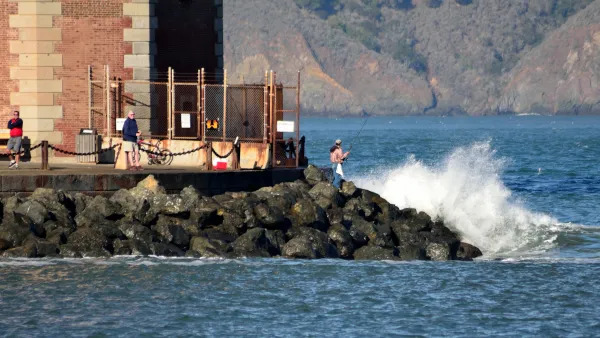
Although sea levels could rise by at least a foot in the next decade, reports Ezra David Romero, a developer is planning to go ahead with a controversial housing development on the shores of San Francisco Bay.
The project, which would build 469 badly needed housing units in Newark, would be located in a federal flood zone just outside the jurisdiction of the Bay Conservation and Development Commission. Despite the developer's plan to "drive in around 100,000 truckloads of dirt to raise the homes above potential stormwaters" and "line the banks with rocks to protect houses from waves," environmental groups say the measures aren't enough to mitigate anticipated damage.
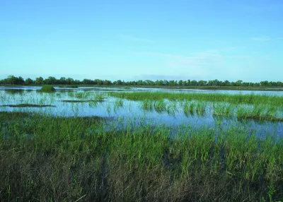
In addition to the threat posed to the homes themselves, environmentalists argue that building the project would destroy local wetlands that serve as crucial natural flood protection. Thanks to urban development, only 10 percent of marshland in San Francisco Bay remains today. While the city has acknowledged the risk, it is also looking to the county and regional authorities to implement 'area-wide' mitigation projects.
Experts recommend clearer state and regional guidelines for approaching developments in coastal areas. "BCDC’s new regional sea level rise adaptation plan, Bay Adapt, includes a potential fix and is a road map for agencies and cities to create new policies to interpret the effects of climate change better."
FULL STORY: The Bay Is Rising. Newark Residents Wonder Why The City Plans to Develop Its Shoreline

Bay Area's First Climate Adaptation Project Could Be a North Bay Highway
State Route 37 is a vital highway connecting four North Bay counties plagued by two unrelated problems: chronic flooding during high tides and traffic congestion. Fixing the problem will set a precedent for Bay Area climate adaptation.
An In-Depth Look at Sea Level Rise in the San Francisco Bay Area
The San Francisco Chronicle gives feature-length, in-depth treatment to the looming dangers of sea level rise, which are more likely to encroach on the built and natural environments of the Bay Area with every passing year.
How Cities Can Curb Climate Change and Protect Vulnerable Residents
A new U.N. report urges cities to upgrade their infrastructure to bolster climate resilience and build more sustainable, climate-friendly places.

National Parks Layoffs Will Cause Communities to Lose Billions
Thousands of essential park workers were laid off this week, just before the busy spring break season.

Retro-silient?: America’s First “Eco-burb,” The Woodlands Turns 50
A master-planned community north of Houston offers lessons on green infrastructure and resilient design, but falls short of its founder’s lofty affordability and walkability goals.

Delivering for America Plan Will Downgrade Mail Service in at Least 49.5 Percent of Zip Codes
Republican and Democrat lawmakers criticize the plan for its disproportionate negative impact on rural communities.

Test News Post 1
This is a summary

Test News Headline 46
Test for the image on the front page.

Balancing Bombs and Butterflies: How the National Guard Protects a Rare Species
The National Guard at Fort Indiantown Gap uses GIS technology and land management strategies to balance military training with conservation efforts, ensuring the survival of the rare eastern regal fritillary butterfly.
Urban Design for Planners 1: Software Tools
This six-course series explores essential urban design concepts using open source software and equips planners with the tools they need to participate fully in the urban design process.
Planning for Universal Design
Learn the tools for implementing Universal Design in planning regulations.
EMC Planning Group, Inc.
Planetizen
Planetizen
Mpact (formerly Rail~Volution)
Great Falls Development Authority, Inc.
HUDs Office of Policy Development and Research
NYU Wagner Graduate School of Public Service