


It no longer takes a storm to cause flooding in many coastal areas of the United States. Galveston, Texas could eventually face floods more than half the days of the year.
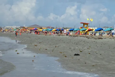
The National Oceanic and Atmospheric Administration (NOAA) recently released updated predictions that show rising flood risks in Galveston, reports Emily Foxhall in a paywalled article for the Houston Chronicle.
According to the new projections, “High tides could flood Galveston streets as many as 210 days a year by 2050, compared with as many as 17 days in 2022,” reports Foxhall.
“The expected number of high-tide flood days in Galveston’s is nearly the worst of any coastal spot in the country because this region suffers from land that’s sinking in addition to sea levels that are rising,” adds Foxhall.
William Sweet, a NOAA oceanographer, is quoted in the article saying the need to build sea-level-rise-resilient infrastructure is already present in Galveston. “The city of Galveston is spending millions to build pump stations to push water back out to the bay when the tide is up. But projects of this nature take time,” writes Foxhall.
FULL STORY: Galveston could flood 210 days of the year by 2050, a new NOAA prediction shows

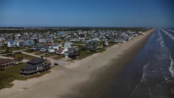
Looking for a Beach House? Check Your Risk First.
A new report from the insurance industry names the historic town of Galveston, Texas as the riskiest place to buy a beach house in the United States.
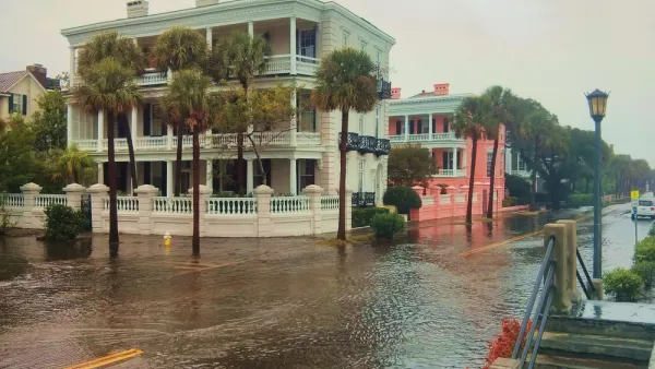
As Development in Flood-Prone Areas Continues, Cities Are Slow to Respond
Drawn by affordable property, low taxes, and job opportunities, high numbers of Americans continue to move to flood-prone areas even as the threat of catastrophic flooding grows.
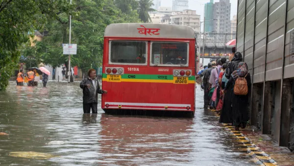
Over 80 Million People Live in Flood Zones
New research shows a 24% increase in people living in flood-prone areas since 2000, prompting calls for increased adaptation measures.

National Parks Layoffs Will Cause Communities to Lose Billions
Thousands of essential park workers were laid off this week, just before the busy spring break season.

Retro-silient?: America’s First “Eco-burb,” The Woodlands Turns 50
A master-planned community north of Houston offers lessons on green infrastructure and resilient design, but falls short of its founder’s lofty affordability and walkability goals.

Delivering for America Plan Will Downgrade Mail Service in at Least 49.5 Percent of Zip Codes
Republican and Democrat lawmakers criticize the plan for its disproportionate negative impact on rural communities.

Test News Post 1
This is a summary

Test News Headline 46
Test for the image on the front page.

Balancing Bombs and Butterflies: How the National Guard Protects a Rare Species
The National Guard at Fort Indiantown Gap uses GIS technology and land management strategies to balance military training with conservation efforts, ensuring the survival of the rare eastern regal fritillary butterfly.
Urban Design for Planners 1: Software Tools
This six-course series explores essential urban design concepts using open source software and equips planners with the tools they need to participate fully in the urban design process.
Planning for Universal Design
Learn the tools for implementing Universal Design in planning regulations.
EMC Planning Group, Inc.
Planetizen
Planetizen
Mpact (formerly Rail~Volution)
Great Falls Development Authority, Inc.
HUDs Office of Policy Development and Research
NYU Wagner Graduate School of Public Service