


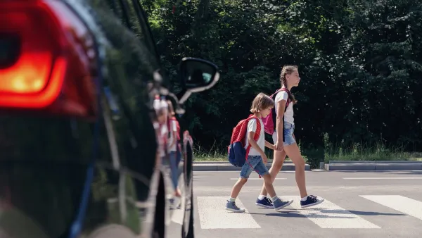
Signs and markings designed for traffic control can make conditions less safe for pedestrians and other road users.

Writing in Streetsblog, Kea Wilson explains how the regulations codified in the Manual on Uniform Traffic Control Devices (MUTCD) can make roads less safe.
“Since the very first center line appeared on a Michigan road in 1911, many have questioned whether the design norms that govern the U.S. transportation network really make roads ‘safe,’ or simply less dangerous than the anarchic days of early motordom — though they're still nowhere near as safe as the days before the car dominated American roads at all.”
As transportation engineer Ian Lockwood explains, “The [signs, signals and markings in the] MUTCD aren't there to make our streets safer … They’re there to make them faster.” Signs and markings are designed to speed up traffic, and are less necessary at slower speeds. Cities that have experimented with removing signage and markings have seen positive results. “In 2016, transportation engineers in London found that when they removed center lines from several 30 mile-per-hour roads, traffic speeds and potential crash severity plummeted — perhaps validating Lockwood's hypothesis that the yellow line deserves some of the blame for traffic violence on U.S. roads, too.”
The concept known as Shared Space was pioneered by Dutch traffic engineer Hans Monderman, “who famously — if counter-intuitively — advised communities throughout Europe and Australia facing safety challenges to remove streetlights, lane markers, and even crosswalks, rather than following conventional wisdom that would have them install even more of them.” Lockwood adds that a misplaced faith in technology can cause people to behave less cautiously. “The lower tech we go, the more we have to drive responsibly.”
Despite proven increases in actual safety, pedestrians can perceive Shared Space interventions as making streets less safe. Removing physical curbs can also impede mobility for people with visual impairments who use curbs to identify where the sidewalk ends, for example.
But the ideology behind Shared Space—the belief that roads should be safe for all people—can be a useful approach for shifting focus away from trying to influence driver behavior with signage and designing safer roadways in the first place.
FULL STORY: Counter-Intuitive Department: Sometimes, Traffic Controls Make Streets More Dangerous

US Street Design Manual Inches Toward Safer Roads
The guiding document for U.S. road design is starting to recognize the needs of people walking and biking, but safe streets advocates say more significant changes are needed to reduce the high number of pedestrian deaths and improve connectivity for all road users.

Austin Left Turn Improvements Cut Serious Crashes by Half
Changes to left turn infrastructure and signal timing led to a 47 to 72 percent drop in fatal and serious injury crashes.
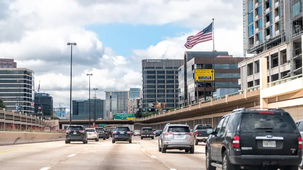
Traffic Tech is Helping Texas Curb Road Deaths
The state is deploying AI-assisted technology to identify dangerous road segments and improve signal timing.

National Parks Layoffs Will Cause Communities to Lose Billions
Thousands of essential park workers were laid off this week, just before the busy spring break season.

Retro-silient?: America’s First “Eco-burb,” The Woodlands Turns 50
A master-planned community north of Houston offers lessons on green infrastructure and resilient design, but falls short of its founder’s lofty affordability and walkability goals.

Delivering for America Plan Will Downgrade Mail Service in at Least 49.5 Percent of Zip Codes
Republican and Democrat lawmakers criticize the plan for its disproportionate negative impact on rural communities.

Test News Post 1
This is a summary

Test News Headline 46
Test for the image on the front page.

Balancing Bombs and Butterflies: How the National Guard Protects a Rare Species
The National Guard at Fort Indiantown Gap uses GIS technology and land management strategies to balance military training with conservation efforts, ensuring the survival of the rare eastern regal fritillary butterfly.
Urban Design for Planners 1: Software Tools
This six-course series explores essential urban design concepts using open source software and equips planners with the tools they need to participate fully in the urban design process.
Planning for Universal Design
Learn the tools for implementing Universal Design in planning regulations.
EMC Planning Group, Inc.
Planetizen
Planetizen
Mpact (formerly Rail~Volution)
Great Falls Development Authority, Inc.
HUDs Office of Policy Development and Research
NYU Wagner Graduate School of Public Service