


Coastal erosion and rising sea levels threaten one of the nation’s most scenic—and strategically important—rail corridors.

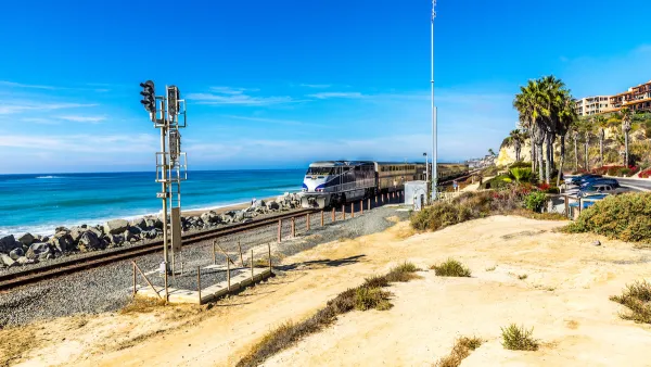
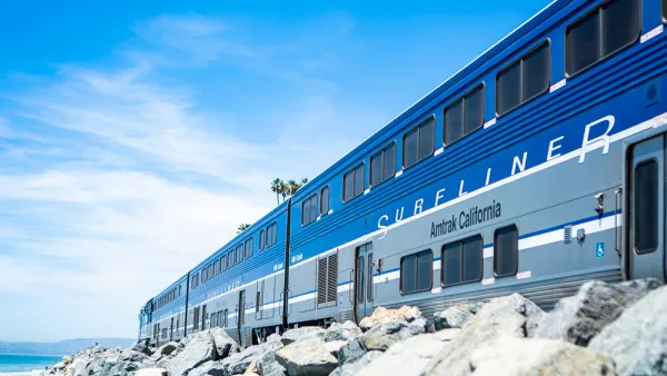
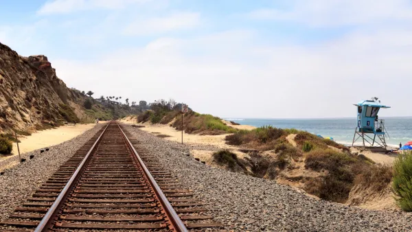
The coastal rail corridor between San Diego and Santa Barbara faces growing risks from coastal erosion and climate change, according to a California Senate Transportation Subcommittee. As Phil Diehl explains in The San Diego Union-Tribune, “Landslides and cliff collapses have periodically stopped the trains in Del Mar and San Clemente, and many other places also need improvements and protection from sea-level rise along the 351-mile Los Angeles-San Diego-San Luis Obispo corridor.” Yet the corridor provides a crucial transportation link for passengers, freight, and military transportation.
According to a Senate report, the cost of making safety improvements to the Los Angeles-San Diego-San Luis Obispo (LOSSAN) corridor could be more than $20 billion. With seven different right-of-way owners, the corridor is a complex system with little precedent in the United States. Researcher Genvieve Giuliano says a long-term solution would be “to create a single statewide agency that would fully integrate the multiple agencies that provide the separate passenger services — Amtrak, Coaster and Metrolink.”
Farther up the coast, the state’s Department of Transportation (Caltrans) recently completed its first erosion mitigation project for a roadway, moving a highway segment 400 feet to protect it from landslides.
FULL STORY: Climate change imperils San Diego County’s coastal rail corridor, panelists say

Storms Sever California Rail Line—Again
The coast-hugging rail corridor linking Los Angeles and San Diego faces an uncertain future as mudslides once again force part of the line to close.
Sea Level Rise Threatens an Iconic California Train
A scenic Southern California line could require relocation as rising sea levels destabilize the coastal soil that supports its tracks.
Southern California Rail Service Resumes After Landslide
The corridor has been closed multiple times in the past year as erosion and landslides put coastal rail infrastructure in jeopardy.

National Parks Layoffs Will Cause Communities to Lose Billions
Thousands of essential park workers were laid off this week, just before the busy spring break season.

Retro-silient?: America’s First “Eco-burb,” The Woodlands Turns 50
A master-planned community north of Houston offers lessons on green infrastructure and resilient design, but falls short of its founder’s lofty affordability and walkability goals.

Delivering for America Plan Will Downgrade Mail Service in at Least 49.5 Percent of Zip Codes
Republican and Democrat lawmakers criticize the plan for its disproportionate negative impact on rural communities.

Test News Post 1
This is a summary

Test News Headline 46
Test for the image on the front page.

Balancing Bombs and Butterflies: How the National Guard Protects a Rare Species
The National Guard at Fort Indiantown Gap uses GIS technology and land management strategies to balance military training with conservation efforts, ensuring the survival of the rare eastern regal fritillary butterfly.
Urban Design for Planners 1: Software Tools
This six-course series explores essential urban design concepts using open source software and equips planners with the tools they need to participate fully in the urban design process.
Planning for Universal Design
Learn the tools for implementing Universal Design in planning regulations.
EMC Planning Group, Inc.
Planetizen
Planetizen
Mpact (formerly Rail~Volution)
Great Falls Development Authority, Inc.
HUDs Office of Policy Development and Research
NYU Wagner Graduate School of Public Service