


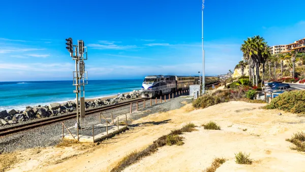
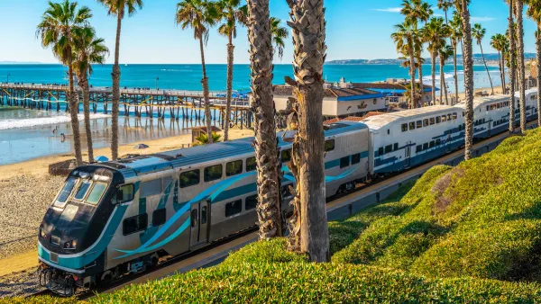
A scenic Southern California line could require relocation as rising sea levels destabilize the coastal soil that supports its tracks.
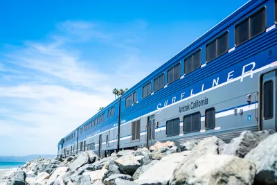
California’s most scenic train trip faces an uncertain future as rising sea levels threaten the ground beneath its tracks, forcing Amtrak and the regional Metrolink agency to evaluate how to stabilize the faltering coastline and protect the tracks. Allison Nicole Smith reports on the story for Bloomberg CityLab.
On September 30, Amtrak and Metrolink stopped service on a stretch of rail south of Los Angeles due to safety concerns. “After Tropical Storm Kay tore into the Golden State’s seaboard with heavy rains and high tides, geotechnical sensors detected that the fragile landscape of sand and rock underneath the tracks near San Clemente was moving as much as nearly a half an inch a day.” The same segment was shut down last September for three weeks.
Officials secured $6 million to stabilize the tracks. “The plan is to drive large metal anchors into the adjacent slope to prevent it from pushing the track further toward the coast, according to a news release.” The San Diego Association of Governments (SANDAG) has developed a plan to move the tracks into an inland tunnel at a cost of over $2.5 billion. Other alternatives include building seawalls or other coastal barriers.
The long-term future of the line—and coastal development in general—remains unclear as climate change speeds up coastal erosion in California, where 44 percent of residents live along the coast.
FULL STORY: The Race to Save a Scenic California Train From Rising Seas


State Leaders Warn of Risks to Southern California Rail Corridor
Coastal erosion and rising sea levels threaten one of the nation’s most scenic—and strategically important—rail corridors.
Storms Sever California Rail Line—Again
The coast-hugging rail corridor linking Los Angeles and San Diego faces an uncertain future as mudslides once again force part of the line to close.
Southern California Rail Corridor In Danger From Erosion, Lack of Leadership
With a patchwork of management and local agencies involved, the imperiled rail corridor has no unified plan for improving or relocating tracks impacted by coastal erosion.

National Parks Layoffs Will Cause Communities to Lose Billions
Thousands of essential park workers were laid off this week, just before the busy spring break season.

Retro-silient?: America’s First “Eco-burb,” The Woodlands Turns 50
A master-planned community north of Houston offers lessons on green infrastructure and resilient design, but falls short of its founder’s lofty affordability and walkability goals.

Delivering for America Plan Will Downgrade Mail Service in at Least 49.5 Percent of Zip Codes
Republican and Democrat lawmakers criticize the plan for its disproportionate negative impact on rural communities.

Test News Post 1
This is a summary

Test News Headline 46
Test for the image on the front page.

Balancing Bombs and Butterflies: How the National Guard Protects a Rare Species
The National Guard at Fort Indiantown Gap uses GIS technology and land management strategies to balance military training with conservation efforts, ensuring the survival of the rare eastern regal fritillary butterfly.
Urban Design for Planners 1: Software Tools
This six-course series explores essential urban design concepts using open source software and equips planners with the tools they need to participate fully in the urban design process.
Planning for Universal Design
Learn the tools for implementing Universal Design in planning regulations.
EMC Planning Group, Inc.
Planetizen
Planetizen
Mpact (formerly Rail~Volution)
Great Falls Development Authority, Inc.
HUDs Office of Policy Development and Research
NYU Wagner Graduate School of Public Service