


With a patchwork of management and local agencies involved, the imperiled rail corridor has no unified plan for improving or relocating tracks impacted by coastal erosion.
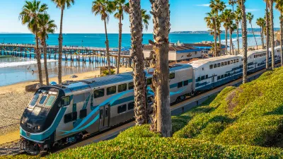
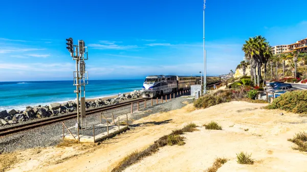
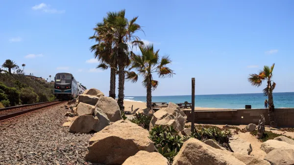
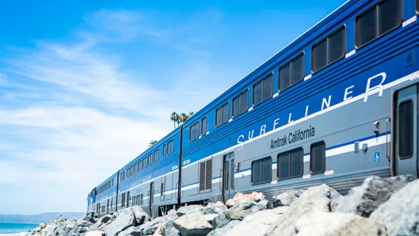
The rail corridor spanning 351 miles between San Luis Obispo and San Diego on the Southern California coast faces an uncertain future as erosion and sea level rise threaten the coastline that much of the tracks run along. As Melanie Curry explains in Streetsblog California, the line “serves as an important passenger connection for points between Santa Barbara and San Diego, and the route is also a key freight corridor, directly serving the ports of San Diego and Port Heuneme [sic].”
With the southern end of the corridor “closed more than it’s been open” in the last few months, “The [California] legislature this year formed a subcommittee to discuss the considerable problems facing this crucial rail route, and today held a second hearing on the topic (the first was held in May).”
The subcommittee didn’t reach any conclusions about how to move forward, Curry adds. “Further threats from sea level rise and rain seepage will continue their inexorable work to erode the cliffs. And a very wide range of agencies and operators have some role in maintaining rails and service, and in planning future work - but there is no clear leader.” Curry notes that “Most of the emergency work over the last 23 months has been in response to landslides from properties owned by private individuals above the cliffs, and has ranged from building retaining walls to adding riprap and sand along the coast.”
Darrel Johnson, the CEO of Orange County Transportation Authority (OCTA), said it became obvious during the hearings that “that the state has a very clear process for highway emergencies. This does not exist for publicly owned railroads.”
FULL STORY: What Is to Become of Southern California’s Coastal Rail Corridor?

Storms Sever California Rail Line—Again
The coast-hugging rail corridor linking Los Angeles and San Diego faces an uncertain future as mudslides once again force part of the line to close.
State Leaders Warn of Risks to Southern California Rail Corridor
Coastal erosion and rising sea levels threaten one of the nation’s most scenic—and strategically important—rail corridors.
Sea Level Rise Threatens an Iconic California Train
A scenic Southern California line could require relocation as rising sea levels destabilize the coastal soil that supports its tracks.

National Parks Layoffs Will Cause Communities to Lose Billions
Thousands of essential park workers were laid off this week, just before the busy spring break season.

Retro-silient?: America’s First “Eco-burb,” The Woodlands Turns 50
A master-planned community north of Houston offers lessons on green infrastructure and resilient design, but falls short of its founder’s lofty affordability and walkability goals.

Delivering for America Plan Will Downgrade Mail Service in at Least 49.5 Percent of Zip Codes
Republican and Democrat lawmakers criticize the plan for its disproportionate negative impact on rural communities.

Test News Post 1
This is a summary

Test News Headline 46
Test for the image on the front page.

Balancing Bombs and Butterflies: How the National Guard Protects a Rare Species
The National Guard at Fort Indiantown Gap uses GIS technology and land management strategies to balance military training with conservation efforts, ensuring the survival of the rare eastern regal fritillary butterfly.
Urban Design for Planners 1: Software Tools
This six-course series explores essential urban design concepts using open source software and equips planners with the tools they need to participate fully in the urban design process.
Planning for Universal Design
Learn the tools for implementing Universal Design in planning regulations.
EMC Planning Group, Inc.
Planetizen
Planetizen
Mpact (formerly Rail~Volution)
Great Falls Development Authority, Inc.
HUDs Office of Policy Development and Research
NYU Wagner Graduate School of Public Service