


One-fourth of the state’s land falls within 100-year or 500-year floodplains.
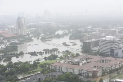
A draft statewide flood plan for Texas estimates that one in six of the state’s residents — or over 5 million people — live in a flood-prone area, reports Alejandra Martinez in The Texas Tribune.
The plan, developed by the Texas Water Development Board (TWDB), was a result of a 2019 law passed after Hurricane Harvey devastated the Houston area.
As Martinez explains, “The plan used existing flood data to create the maps that served as a baseline, but many state regions either didn't have flood maps, or used outdated maps. Local water managers filled the gaps with their knowledge and the TWDB contracted flood risk modeling data company Fathom to help.”
The TWDB recommends a variety of flood mitigation strategies, but Martinez notes that “the state doesn’t have a reliable source of revenue for flood projects unless state lawmakers approve additional funding each legislative session.”
The TWDB is also asking the state to implement an early warning system for flooding and provide technical assistance to small and rural communities. “Because money is limited for flood projects, the regional groups recommended that the state give counties the authority to collect drainage fees in unincorporated areas — currently only cities can charge such fees. The regional groups argue this would help counties self-finance flood mitigation and drainage projects outside of city limits.”
FULL STORY: Texas’ first-ever statewide flood plan estimates 5 million live in flood-prone areas


3D Modeling Aids in Predicting Hurricane Damage
Texas researchers are testing the tool in Galveston, where Hurricane Ike caused billions in damage in 2008.
New York Flood Control Plan Takes Lessons From the Dutch
The Netherlands has a long history of flood mitigation. U.S. cities, threatened by coastal flooding and erosion, are taking note.

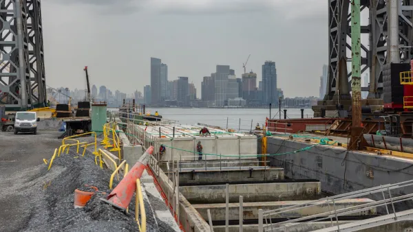
East River Floodgates Rising in NYC
A tour of new infrastructure designed to protect the city’s East Side from catastrophic flooding.

National Parks Layoffs Will Cause Communities to Lose Billions
Thousands of essential park workers were laid off this week, just before the busy spring break season.

Retro-silient?: America’s First “Eco-burb,” The Woodlands Turns 50
A master-planned community north of Houston offers lessons on green infrastructure and resilient design, but falls short of its founder’s lofty affordability and walkability goals.

Delivering for America Plan Will Downgrade Mail Service in at Least 49.5 Percent of Zip Codes
Republican and Democrat lawmakers criticize the plan for its disproportionate negative impact on rural communities.

Test News Post 1
This is a summary

Test News Headline 46
Test for the image on the front page.

Balancing Bombs and Butterflies: How the National Guard Protects a Rare Species
The National Guard at Fort Indiantown Gap uses GIS technology and land management strategies to balance military training with conservation efforts, ensuring the survival of the rare eastern regal fritillary butterfly.
Urban Design for Planners 1: Software Tools
This six-course series explores essential urban design concepts using open source software and equips planners with the tools they need to participate fully in the urban design process.
Planning for Universal Design
Learn the tools for implementing Universal Design in planning regulations.
EMC Planning Group, Inc.
Planetizen
Planetizen
Mpact (formerly Rail~Volution)
Great Falls Development Authority, Inc.
HUDs Office of Policy Development and Research
NYU Wagner Graduate School of Public Service