


What could the city look like if budget and bureaucracy were no object?

In interviews with Houston Public Media, Houston mobility advocates and residents told Michael Hagerty what changes they would make to their city’s streets if they could.
One listener suggested getting rid of freeways inside the 610 loop and replacing them with surface boulevards that offer the potential for more uses.
Another wondered whether elevating roadways could prevent further road expansions. One listener wants to replace a local highway with a high-speed rail system complete with rail and bus connections to other destinations.
Some respondents criticized traffic calming measures, expressing the common concern that they negatively impact local businesses (bike lanes and other road safety infrastructure have been shown to be good for business). One listener called for adding a left turn lane and banning right turns on red on West Dallas Street to improve pedestrian safety.
Ultimately, it seems that Houston residents have opinions on their roadways — and many of them want to see safety improvements, pedestrian and bike infrastructure, and more transit options.
FULL STORY: If you could wave a wand and redesign a Houston road, what would you change and why?


Seattle Mobility Advocates Say City Should Triple Transportation Levy
A measure set to go before voters in November will fund road safety and mobility projects, but advocates say a much bigger investment is required to meet the city’s needs.
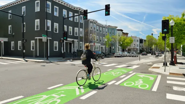
Multimodal Improvements Coming to Houston
The city is continuing its investment in safety and accessibility improvements for transit riders, pedestrians, and cyclists.
NACTO Releases Updated Urban Bikeway Guide
The third edition of the nationally recognized road design guide includes detailed design advice for roads that prioritize safety and accessibility for all users.

National Parks Layoffs Will Cause Communities to Lose Billions
Thousands of essential park workers were laid off this week, just before the busy spring break season.

Retro-silient?: America’s First “Eco-burb,” The Woodlands Turns 50
A master-planned community north of Houston offers lessons on green infrastructure and resilient design, but falls short of its founder’s lofty affordability and walkability goals.

Delivering for America Plan Will Downgrade Mail Service in at Least 49.5 Percent of Zip Codes
Republican and Democrat lawmakers criticize the plan for its disproportionate negative impact on rural communities.

Test News Post 1
This is a summary

Test News Headline 46
Test for the image on the front page.

Balancing Bombs and Butterflies: How the National Guard Protects a Rare Species
The National Guard at Fort Indiantown Gap uses GIS technology and land management strategies to balance military training with conservation efforts, ensuring the survival of the rare eastern regal fritillary butterfly.
Urban Design for Planners 1: Software Tools
This six-course series explores essential urban design concepts using open source software and equips planners with the tools they need to participate fully in the urban design process.
Planning for Universal Design
Learn the tools for implementing Universal Design in planning regulations.
EMC Planning Group, Inc.
Planetizen
Planetizen
Mpact (formerly Rail~Volution)
Great Falls Development Authority, Inc.
HUDs Office of Policy Development and Research
NYU Wagner Graduate School of Public Service