


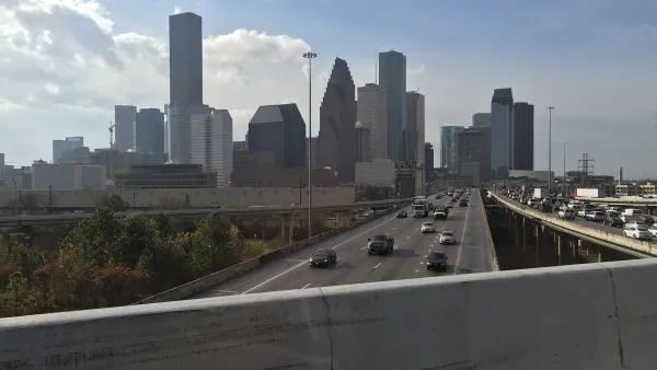
Opportunities abound for Houston to capitalize on otherwise unused space beneath its wide network of freeways.
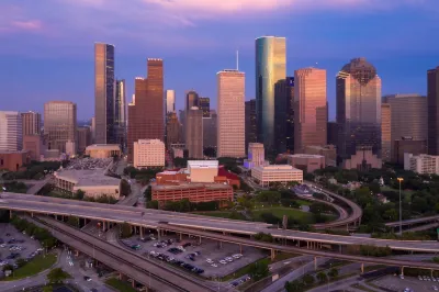
With the numerous wide freeways throughout the City of Houston, it's becoming more apparent that the space beneath the many overpasses can, and should, be made multifunctional. In cities like Houston where space is limited, these spaces can be reimagined to provide shade, shelter from rain, and safe under-crossings for pedestrians and cyclists. Even adding simple interventions such as lighting or a splash of color to the environment can help make space underneath freeways more attractive and safer.
As Dug Begley explains in a Houston Chronicle article, public officials are engaging with communities to get a better understanding of how these spaces can best benefit the surrounding neighborhoods and residents. Options include parking, trails, vegetation, stormwater detention, and programmed park space.
The article highlights the importance of minimizing unused or wasted space. Communities within the U.S. and around the globe have already started repurposing beneath freeway spaces for a wide variety of uses including recreation, public art, and playgrounds. With a changing climate that is making summers increasingly hotter, these spaces represent prime opportunities to take advantage of already shaded areas. Engaging with communities to reimagine these spaces can also signify a step in building trust with the surrounding communities, some of which may have been disproportionately impacted by the presence of the freeways. Even with minimal intervention, programming, and maintenance, these under-crossings can show subtle “cues to care” that will increase the perception of safety and signify investment. Houston, as well as other communities strapped for space, should continue to take advantage of the many benefits and options that these unique places can provide.
FULL STORY: Houston has a ton of freeways. And a big opportunity to reimagine the space underneath them.


Interactive Map Highlights Freeway-Related Displacement in Houston
A new map illustrates the neighborhoods and buildings that were razed to make way for freeways and estimates the number of people displaced by roadways.
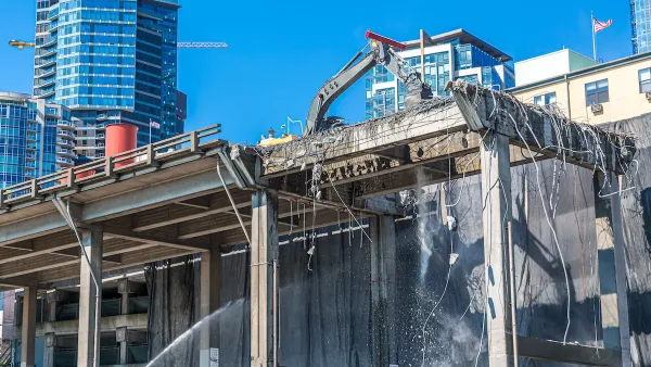
Contentious Houston Freeway Widening Project Inches Forward
Federal officials have given TxDOT the go-ahead to resume work on a small portion of a controversial interstate widening project in downtown Houston.
Highway Removal Slowed by Outdated Policy, Lack of Committed Funding
Resistance from state transportation departments and precarious funding sources mean highway removal projects are few and far between, despite their benefits.

National Parks Layoffs Will Cause Communities to Lose Billions
Thousands of essential park workers were laid off this week, just before the busy spring break season.

Retro-silient?: America’s First “Eco-burb,” The Woodlands Turns 50
A master-planned community north of Houston offers lessons on green infrastructure and resilient design, but falls short of its founder’s lofty affordability and walkability goals.

Delivering for America Plan Will Downgrade Mail Service in at Least 49.5 Percent of Zip Codes
Republican and Democrat lawmakers criticize the plan for its disproportionate negative impact on rural communities.

Test News Post 1
This is a summary

Test News Headline 46
Test for the image on the front page.

Balancing Bombs and Butterflies: How the National Guard Protects a Rare Species
The National Guard at Fort Indiantown Gap uses GIS technology and land management strategies to balance military training with conservation efforts, ensuring the survival of the rare eastern regal fritillary butterfly.
Urban Design for Planners 1: Software Tools
This six-course series explores essential urban design concepts using open source software and equips planners with the tools they need to participate fully in the urban design process.
Planning for Universal Design
Learn the tools for implementing Universal Design in planning regulations.
EMC Planning Group, Inc.
Planetizen
Planetizen
Mpact (formerly Rail~Volution)
Great Falls Development Authority, Inc.
HUDs Office of Policy Development and Research
NYU Wagner Graduate School of Public Service