


Anticipating the opening of two new stations in 2024, the Seattle Department of Transportation released a study prioritizing bike infrastructure in the surrounding areas.
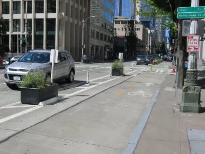
A new study from the Seattle Department of Transportation (SDOT) recommends bike and pedestrian improvements for two new light rail stations being built on the city's north side, which currently have few connections to the existing bike network. A map showing "level of traffic stress" for people on bikes indicates mostly high-stress routes in the area surrounding the two stations. "Pretty much every east-west route someone would use to access either station" is a high-stress corridor, writes Ryan Packer, which makes it difficult for bike commuters to access the train.
The projects proposed in the study build on top of improvements that SDOT already plans to implement at the new stations and would improve safety and connectivity between the train stations and other parts of town. The highest-ranked priority projects—which include improving the I-5 crossing at 130th Street, adding a shared-use path to 145th Street, widening and improving the Jackson Park trail, and extending bike lanes on Roosevelt Way—involve improvements that provide direct access to the future stations. "The rest of the network builds on these projects," making them part of a crucial foundation for improving Seattle's bike and pedestrian infrastructure.
The study lays out proposed improvements, but funding for the projects remains an open question. "Identifying funding sources is pretty important to getting these actually built, but it’s likely there will be a lot of competition for those pots of money when they become available," writes Packer.
FULL STORY: New study recommends slew of biking improvements around coming north Seattle light rail stations

Seattle Mayor Raises Transportation Levy by $100 Million
The proposal sent to City Council includes more funding for multimodal transportation and road safety.

Seattle Mobility Advocates Say City Should Triple Transportation Levy
A measure set to go before voters in November will fund road safety and mobility projects, but advocates say a much bigger investment is required to meet the city’s needs.
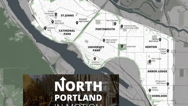
North Portland in Motion Launches with Goals to Improve Walking, Biking, and Transit
The Portland Bureau of Transportation continues its work of drafting transportation plans targeted to specific geographic corners of the city,

National Parks Layoffs Will Cause Communities to Lose Billions
Thousands of essential park workers were laid off this week, just before the busy spring break season.

Retro-silient?: America’s First “Eco-burb,” The Woodlands Turns 50
A master-planned community north of Houston offers lessons on green infrastructure and resilient design, but falls short of its founder’s lofty affordability and walkability goals.

Delivering for America Plan Will Downgrade Mail Service in at Least 49.5 Percent of Zip Codes
Republican and Democrat lawmakers criticize the plan for its disproportionate negative impact on rural communities.

Test News Post 1
This is a summary

Test News Headline 46
Test for the image on the front page.

Balancing Bombs and Butterflies: How the National Guard Protects a Rare Species
The National Guard at Fort Indiantown Gap uses GIS technology and land management strategies to balance military training with conservation efforts, ensuring the survival of the rare eastern regal fritillary butterfly.
Urban Design for Planners 1: Software Tools
This six-course series explores essential urban design concepts using open source software and equips planners with the tools they need to participate fully in the urban design process.
Planning for Universal Design
Learn the tools for implementing Universal Design in planning regulations.
EMC Planning Group, Inc.
Planetizen
Planetizen
Mpact (formerly Rail~Volution)
Great Falls Development Authority, Inc.
HUDs Office of Policy Development and Research
NYU Wagner Graduate School of Public Service