


Location intelligence is transforming decision-making, with an increasing number and type of organizations modernizing operations with a geographic approach to problem-solving, planning, and prediction.
Location intelligence is the process of deriving meaningful insights from geospatial data to solve specific problems. This involves layering multiple data sets spatially and/or chronologically, for easy reference on a map, and its applications span industries, categories, and organizations. Location intelligence is facilitated by the use of geographical information system (GIS) tools which enable analysts to effectively and efficiently collect, stores, analyze, and visualize data.
Location intelligence experts can use a variety of spatial and business analytical tools to measure optimal locations for operating a business or providing a service. They begin with defining the business ecosystem which is influenced by many interconnected factors, including (but are not limited to): culture, lifestyle, labor, healthcare, cost of living, crime, economic climate, and education.
In this post, Esri, the well-known GIS software company, explains how leaders in business and government are applying location technology to meet a wide variety of needs. Examples of location intelligence use cases include finding optimal locations in retail site selection, managing assets in real time, supply chain optimization, and building or maintaining vital infrastructure. Esri points out that location is key to solving many of today's challenges as geography pulls together all key information about important issues such as infrastructure modernization, sustainability, climate change, environmental management, and social equity.
FULL STORY: Location Intelligence: Insights that transform decision-making


New Book Shows How Geographic Technology Tackles Global Challenges
In his new book, Jack Dangermond explores the transformative impact of GIS technology in solving global challenges through spatial data, highlighting its widespread application across sectors and its potential to design sustainable futures.

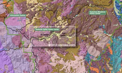
Building Healthier Communities: The Role of GIS in Park Planning
Integrating Geographic Information Systems (GIS) into park planning enhances community health by promoting physical activity, supporting mental well-being, fostering social connectedness, and addressing public health crises and climate change.
New Book Highlights How GIS Improves Outcomes
Esri Press recently published a digital book called Mapping the Nation which demonstrates how a geographic approach guides important decisions and addresses challenges around the globe.

Analysis: Cybertruck Fatality Rate Far Exceeds That of Ford Pinto
The Tesla Cybertruck was recalled seven times last year.

National Parks Layoffs Will Cause Communities to Lose Billions
Thousands of essential park workers were laid off this week, just before the busy spring break season.

Retro-silient?: America’s First “Eco-burb,” The Woodlands Turns 50
A master-planned community north of Houston offers lessons on green infrastructure and resilient design, but falls short of its founder’s lofty affordability and walkability goals.

Test News Post 1
This is a summary

Analysis: Cybertruck Fatality Rate Far Exceeds That of Ford Pinto
The Tesla Cybertruck was recalled seven times last year.

Test News Headline 46
Test for the image on the front page.
Urban Design for Planners 1: Software Tools
This six-course series explores essential urban design concepts using open source software and equips planners with the tools they need to participate fully in the urban design process.
Planning for Universal Design
Learn the tools for implementing Universal Design in planning regulations.
EMC Planning Group, Inc.
Planetizen
Planetizen
Mpact (formerly Rail~Volution)
Great Falls Development Authority, Inc.
HUDs Office of Policy Development and Research
NYU Wagner Graduate School of Public Service