


In his new book, Jack Dangermond explores the transformative impact of GIS technology in solving global challenges through spatial data, highlighting its widespread application across sectors and its potential to design sustainable futures.

In The Power of Where, Jack Dangermond, cofounder of Esri, explores the transformative potential of Geographic Information Systems (GIS) technology to address some of the world’s most pressing challenges. The book introduces readers to the geographic approach, which uses spatial data to uncover patterns and provide solutions in areas like climate change, food production, urban planning, and wildlife migration. Through a series of engaging visuals, maps, and real-life stories, Dangermond demonstrates how GIS has become an integral part of everyday life—from managing city infrastructures to conserving natural spaces.
Central to the book is the concept of the geographic approach, which emphasizes spatial thinking as a tool for problem-solving. Dangermond highlights the power of GIS to visualize, analyze, and collaborate on global issues, drawing from his six decades of experience in the field. He emphasizes that GIS technology is already embedded in many sectors, helping with logistics, resource management, and environmental conservation. The book also offers a hands-on experience through a companion website, bringing the technology to life for students, educators, and aspiring GIS users.
Dangermond's narrative also addresses the role of emerging technologies—such as artificial intelligence, 3D visualization, and mobile devices—in enhancing GIS capabilities. With examples from various sectors, the book demonstrates how GIS empowers communities to design sustainable futures. Throughout the text, Dangermond conveys his passion for the power of place and highlights how spatial thinking can bridge human ingenuity with geographic solutions.
FULL STORY: The Power of Where: A Geographic Approach to the World's Greatest Challenges


Building Healthier Communities: The Role of GIS in Park Planning
Integrating Geographic Information Systems (GIS) into park planning enhances community health by promoting physical activity, supporting mental well-being, fostering social connectedness, and addressing public health crises and climate change.

How the National Park Service Uses GIS
A new book demonstrates how the National Park Service uses GIS technology to meet its mission and showcases a selection of maps used for effectively managing national parks.
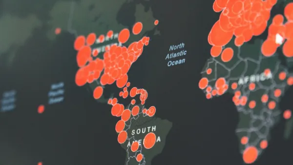
Visualizing the Coronavirus Pandemic
Mapping of the crisis is producing a fascinating and important trove of cartographic records.

National Parks Layoffs Will Cause Communities to Lose Billions
Thousands of essential park workers were laid off this week, just before the busy spring break season.

Retro-silient?: America’s First “Eco-burb,” The Woodlands Turns 50
A master-planned community north of Houston offers lessons on green infrastructure and resilient design, but falls short of its founder’s lofty affordability and walkability goals.

Delivering for America Plan Will Downgrade Mail Service in at Least 49.5 Percent of Zip Codes
Republican and Democrat lawmakers criticize the plan for its disproportionate negative impact on rural communities.

Test News Post 1
This is a summary

Test News Headline 46
Test for the image on the front page.

Balancing Bombs and Butterflies: How the National Guard Protects a Rare Species
The National Guard at Fort Indiantown Gap uses GIS technology and land management strategies to balance military training with conservation efforts, ensuring the survival of the rare eastern regal fritillary butterfly.
Urban Design for Planners 1: Software Tools
This six-course series explores essential urban design concepts using open source software and equips planners with the tools they need to participate fully in the urban design process.
Planning for Universal Design
Learn the tools for implementing Universal Design in planning regulations.
EMC Planning Group, Inc.
Planetizen
Planetizen
Mpact (formerly Rail~Volution)
Great Falls Development Authority, Inc.
HUDs Office of Policy Development and Research
NYU Wagner Graduate School of Public Service