


A new demographic tool from the USDA compiles data about food choices and characteristics, allowing the creation of detailed maps. Edible Geography wonders what using food as a metric will tell us about the U.S.
The Food Environment Atlas was jointly developed by the USDA, the Centers for Disease Control, the National Cancer Institute, the National Farm-to-School Network, and the University of Illinois at Chicago, and it compiles nearly 100 indicators.
"The Atlas currently maps ninety food environment indicators, divided into three broad categories. "Food Choices" includes both measurements of food access and consumption, from the number of supermarkets to per 1000 people to restaurant expenditures per capita. "Health and Well-Being" tracks dietary outcomes, such as hunger, diabetes, and obesity. And "Community Characteristics" adds an extra level of demographic data, including income levels and metro/non-metro status.
The idea, then, is that researchers, policy-makers, and individuals can compare counties across America, comparing and analysing the correlation between food choice, health outcomes, and population characteristics. So, what do you see when you look at America using food as the metric?"
FULL STORY: United States of Food

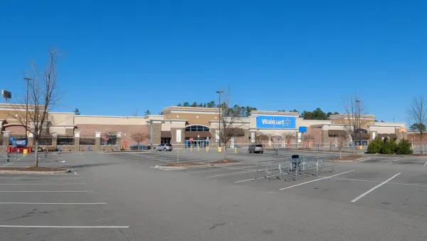
How Smaller Supermarkets Could Transform American Communities
Bigger is not always better.

New Book Shows How Geographic Technology Tackles Global Challenges
In his new book, Jack Dangermond explores the transformative impact of GIS technology in solving global challenges through spatial data, highlighting its widespread application across sectors and its potential to design sustainable futures.

Building Healthier Communities: The Role of GIS in Park Planning
Integrating Geographic Information Systems (GIS) into park planning enhances community health by promoting physical activity, supporting mental well-being, fostering social connectedness, and addressing public health crises and climate change.

National Parks Layoffs Will Cause Communities to Lose Billions
Thousands of essential park workers were laid off this week, just before the busy spring break season.

Retro-silient?: America’s First “Eco-burb,” The Woodlands Turns 50
A master-planned community north of Houston offers lessons on green infrastructure and resilient design, but falls short of its founder’s lofty affordability and walkability goals.

Delivering for America Plan Will Downgrade Mail Service in at Least 49.5 Percent of Zip Codes
Republican and Democrat lawmakers criticize the plan for its disproportionate negative impact on rural communities.

Test News Post 1
This is a summary

Test News Headline 46
Test for the image on the front page.

Balancing Bombs and Butterflies: How the National Guard Protects a Rare Species
The National Guard at Fort Indiantown Gap uses GIS technology and land management strategies to balance military training with conservation efforts, ensuring the survival of the rare eastern regal fritillary butterfly.
Urban Design for Planners 1: Software Tools
This six-course series explores essential urban design concepts using open source software and equips planners with the tools they need to participate fully in the urban design process.
Planning for Universal Design
Learn the tools for implementing Universal Design in planning regulations.
EMC Planning Group, Inc.
Planetizen
Planetizen
Mpact (formerly Rail~Volution)
Great Falls Development Authority, Inc.
HUDs Office of Policy Development and Research
NYU Wagner Graduate School of Public Service