


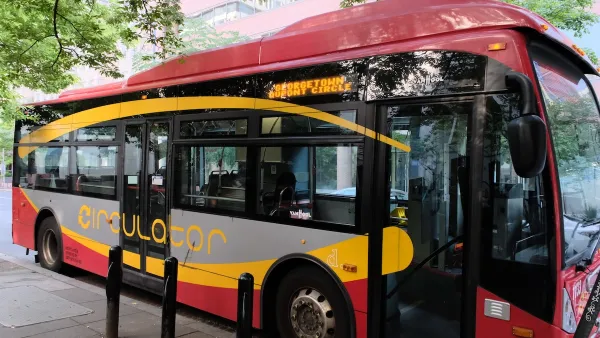
Google announces the addition of D.C.'s Metro and bus routes to their online and mobile maps, including connections to other commuter transit systems.
From the Washington Metropolitan Area Transit Authority's press release:
"Google's promotion of public transit increases awareness of alternatives to driving and gives our riders access to other useful information such as aerial imagery, business listings, user reviews and street views," said Metro General Manager and Chief Executive Officer Richard Sarles.
"In addition to making our transit data available on Google Maps, Metro is committed to making its transit data available so customers get the benefit of the best app tools that are developed for public use," Sarles said.
In August 2010, Metro offered its transit data to the general public for use in developing third-party applications for the Internet and mobile devices. Metro has been a leader in the transit industry in making public real-time data sets. Metro's transit data is available for download from Metro's web site."
Here is a list of the transit systems that Google Transit has linked to so far.
Thanks to Jeffrey Riecke
FULL STORY: Metro riders can plan Metrobus, Metrorail trips on Google


Mobile App Makes DC Transit Easy to Navigate for Visually Impaired Riders
The app gives step-by-step directions and audio and visual cues accessible from anywhere for thousands of bus stops and rail stations.
DC Metro Targets Bus Fare Evasion
The WMATA says roughly 70 percent of riders do not pay fares.

Northern Virginia Projects Counting on Transit
A proposed stadium and other major development projects near transit stations could be hampered by the regional transit agency’s financial woes.

National Parks Layoffs Will Cause Communities to Lose Billions
Thousands of essential park workers were laid off this week, just before the busy spring break season.

Retro-silient?: America’s First “Eco-burb,” The Woodlands Turns 50
A master-planned community north of Houston offers lessons on green infrastructure and resilient design, but falls short of its founder’s lofty affordability and walkability goals.

Delivering for America Plan Will Downgrade Mail Service in at Least 49.5 Percent of Zip Codes
Republican and Democrat lawmakers criticize the plan for its disproportionate negative impact on rural communities.

Test News Post 1
This is a summary

Test News Headline 46
Test for the image on the front page.

Balancing Bombs and Butterflies: How the National Guard Protects a Rare Species
The National Guard at Fort Indiantown Gap uses GIS technology and land management strategies to balance military training with conservation efforts, ensuring the survival of the rare eastern regal fritillary butterfly.
Urban Design for Planners 1: Software Tools
This six-course series explores essential urban design concepts using open source software and equips planners with the tools they need to participate fully in the urban design process.
Planning for Universal Design
Learn the tools for implementing Universal Design in planning regulations.
EMC Planning Group, Inc.
Planetizen
Planetizen
Mpact (formerly Rail~Volution)
Great Falls Development Authority, Inc.
HUDs Office of Policy Development and Research
NYU Wagner Graduate School of Public Service