


Gary Richards, the Roadshow columnist for the San Jose Mercury News, provides many examples of redesigning streets for bikes, peds, and transit throughout the Bay Area, a direct result of the 2008 California Complete Streets legislation.
"Across the Bay Area and California, cities are removing or narrowing lanes and redesigning hundreds of streets to add bike lanes, speed up transit and improve pedestrian safety.
The car remains king, but the crown is slipping.
Some changes began years ago, but the push toward "road diets," as transportation planners call them, took off in 2008, when the state endorsed the concept of "complete streets" for urban neighborhoods in which the entire streetscape, from sidewalk to sidewalk, is geared for safe access and use by nondrivers."
Richards highlights conversion of one-way to two-way streets in downtown San Jose to reduce traffic speeds, a lane 'taking' by a bus rapid transit system in preliminary engineering in San Jose, and street 'makeovers' in the many smaller cities in the Bay Area as well as San Francisco and Oakland. As Hans Larsen, director of San Jose's Dept. of Transportation summarizes, "For decades, planning has focused on the efficient movement of cars. The result has been communities that are dependent on cars and are not conducive to walking and biking and transit."
No longer.
Thanks to National Complete Streets Coalition
FULL STORY: Across the Bay Area, streets are getting a makeover -- with less room for cars

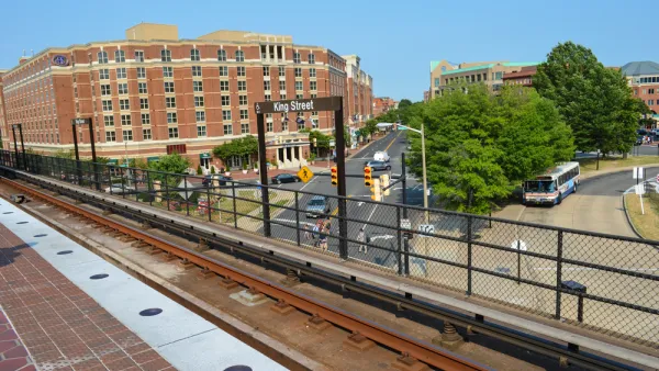
Bus Rapid Transit, Bike Lanes Under Consideration in Alexandria, Virginia
A complete streets makeover is taking shape for Duke Street in Alexandria.
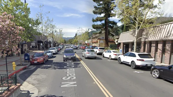
Public Opinion Differs on New Bay Area Road Diet
Some love it; some hate it: The main drag of Downtown Los Gatos, at the southern end of the South Bay Area, got a complete streets makeover.
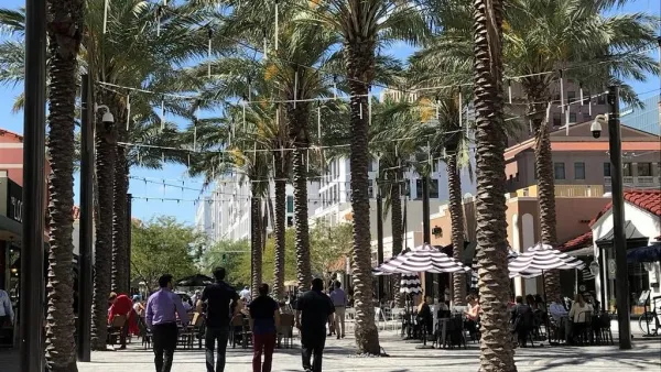
A Dutch 'Shared Street' Is Coming To Miami
A Dutch-style "shared street" is being planned in the Wynwood neighborhood of Miami.

National Parks Layoffs Will Cause Communities to Lose Billions
Thousands of essential park workers were laid off this week, just before the busy spring break season.

Retro-silient?: America’s First “Eco-burb,” The Woodlands Turns 50
A master-planned community north of Houston offers lessons on green infrastructure and resilient design, but falls short of its founder’s lofty affordability and walkability goals.

Delivering for America Plan Will Downgrade Mail Service in at Least 49.5 Percent of Zip Codes
Republican and Democrat lawmakers criticize the plan for its disproportionate negative impact on rural communities.

Test News Post 1
This is a summary

Test News Headline 46
Test for the image on the front page.

Balancing Bombs and Butterflies: How the National Guard Protects a Rare Species
The National Guard at Fort Indiantown Gap uses GIS technology and land management strategies to balance military training with conservation efforts, ensuring the survival of the rare eastern regal fritillary butterfly.
Urban Design for Planners 1: Software Tools
This six-course series explores essential urban design concepts using open source software and equips planners with the tools they need to participate fully in the urban design process.
Planning for Universal Design
Learn the tools for implementing Universal Design in planning regulations.
EMC Planning Group, Inc.
Planetizen
Planetizen
Mpact (formerly Rail~Volution)
Great Falls Development Authority, Inc.
HUDs Office of Policy Development and Research
NYU Wagner Graduate School of Public Service