


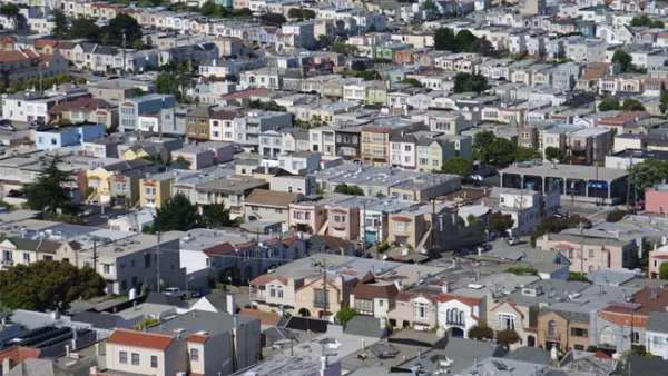
Census data reveals that California is the most urbanized state, with the most dense urban areas. But in California, sprawl, density, crowding, and urbanism are not always what they seem. Fortunately, a new law may help planners make sense of it all.
Josh Stephens delves deeper into the causes and implications of recent census data that ranks the California communities of Los Angeles-Long Beach-Anaheim, San Francisco-Oakland, San Jose, and Delano, as the top four densest urban areas in the entire country.
"Setting aside Delano's unexpected star turn, none of this should come as a surprise to planners in California (which also happens to be the "most urban" state, with 95% urban residency). Density is what happens when you build freeways all over the place and everyone gets to live all over the place. For all the objective connotations of these figures, there's no doubt that there's plenty of room for interpretation, which can have deep implications for public policy."
"If cities implement the tenets of SB 375's Sustainable Communities Strategies--regional plans being drawn up by the metropolitan planning organizations of San Diego, Sacramento, the Bay Area, and Southern California (Los Angeles)--then density may no longer be hidden. It will be plain to see in the streetscapes. And if California residents can accept the fact that we are, indeed, an urban state, maybe, by the time we hit 8,000 per square mile, we'll look like one too."
Thanks to Josh Stephens
FULL STORY: Parsing California's Density Bombshell in 2010 Census Data

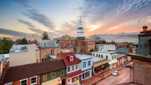
SPUR: The Bay Area Has A Sprawl Problem
SPUR states its case clearly by announcing, “We believe cities are the key to our future” at the opening of a new report called “SPUR’s Agenda for Change.”
New Census Numbers Detail Surprising Facts About Urban Density
John King considers a new report released by the Census Bureau on Monday, which finds that of the ten most densely populated urbanized areas in the United States, nine are in the West.
Commentary: We Need a Return to the Adaptability of Traditional Urban Form
How the rigidity of modern suburban development fails to prepare cities for the future.

National Parks Layoffs Will Cause Communities to Lose Billions
Thousands of essential park workers were laid off this week, just before the busy spring break season.

Retro-silient?: America’s First “Eco-burb,” The Woodlands Turns 50
A master-planned community north of Houston offers lessons on green infrastructure and resilient design, but falls short of its founder’s lofty affordability and walkability goals.

Delivering for America Plan Will Downgrade Mail Service in at Least 49.5 Percent of Zip Codes
Republican and Democrat lawmakers criticize the plan for its disproportionate negative impact on rural communities.

Test News Post 1
This is a summary

Test News Headline 46
Test for the image on the front page.

Balancing Bombs and Butterflies: How the National Guard Protects a Rare Species
The National Guard at Fort Indiantown Gap uses GIS technology and land management strategies to balance military training with conservation efforts, ensuring the survival of the rare eastern regal fritillary butterfly.
Urban Design for Planners 1: Software Tools
This six-course series explores essential urban design concepts using open source software and equips planners with the tools they need to participate fully in the urban design process.
Planning for Universal Design
Learn the tools for implementing Universal Design in planning regulations.
EMC Planning Group, Inc.
Planetizen
Planetizen
Mpact (formerly Rail~Volution)
Great Falls Development Authority, Inc.
HUDs Office of Policy Development and Research
NYU Wagner Graduate School of Public Service