


Mark Wilson profiles Google Maps' new feature - Photo Tours - which combs the Internet to provide 3-D tours of popular locations around the world.
Stitching together publicly available geotagged photos from sites such as Panoramio and Picasa, Google's advanced algorithm and state-of-the-art computer vision techniques produces pre-rendered 3-D animations of locations around the world, from the Coliseum to the Statue of Liberty. "The result is the view of a place from the hive mind, a collective map created from our inner auteurs."
While the feature is fairly new, its potential has Wilson buoyant with anticipation:
"As of now, the feature is clearly in its infancy. The tours are pre-rendered animations that can't be explored at-will like Street View, and just a few spots are available, as Google is manually tweaking its new crowdsourcing algorithms as it goes. But let's fast forward just a few years. As all of our pictures become geotagged by our smartphones, and as we only share more and more to the cloud, Google could combine the perspectives of, not just everyone at a single tourist destination, but everyone everywhere on the planet. They could assemble trillions of images from billions of people to create an interactive map of, not just our streets, but every inch of the entire globe."
FULL STORY: Google’s Photo Tours Suggest A Crowdsourced, 3-D World Map


Google Maps Introduces New Transit, EV Features
It will now be easier to find electric car charging stations and transit options.
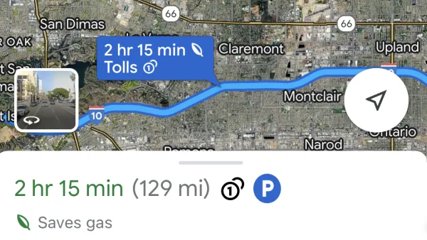
Google Maps Feature Identifies Most Fuel-Efficient Routes
A new feature highlights routes that use the least gas to help users make the most fuel-efficient driving decisions.
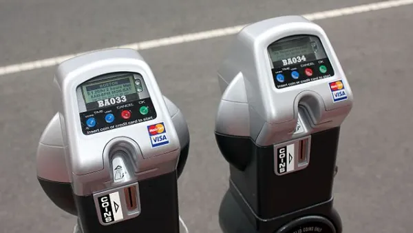
Google Maps Now Lets You Feed Your Parking Meter
Google's newest partnership offers contactless parking meter payments and transit fare purchases.

Analysis: Cybertruck Fatality Rate Far Exceeds That of Ford Pinto
The Tesla Cybertruck was recalled seven times last year.

National Parks Layoffs Will Cause Communities to Lose Billions
Thousands of essential park workers were laid off this week, just before the busy spring break season.

Retro-silient?: America’s First “Eco-burb,” The Woodlands Turns 50
A master-planned community north of Houston offers lessons on green infrastructure and resilient design, but falls short of its founder’s lofty affordability and walkability goals.

Test News Post 1
This is a summary

Analysis: Cybertruck Fatality Rate Far Exceeds That of Ford Pinto
The Tesla Cybertruck was recalled seven times last year.

Test News Headline 46
Test for the image on the front page.
Urban Design for Planners 1: Software Tools
This six-course series explores essential urban design concepts using open source software and equips planners with the tools they need to participate fully in the urban design process.
Planning for Universal Design
Learn the tools for implementing Universal Design in planning regulations.
EMC Planning Group, Inc.
Planetizen
Planetizen
Mpact (formerly Rail~Volution)
Great Falls Development Authority, Inc.
HUDs Office of Policy Development and Research
NYU Wagner Graduate School of Public Service