


The "Best of" roll continues with Emily Badger's list of the most useful tools, maps and data visualizations to make use of municipal open data over the past year.
As recent writings on Planetizen have noted, the emerging methods of urban governance, planning, design, and management made possible by technological advances in data collection, analysis, and communication promise to make our cities better, and more efficient, places to live. As more cities take advantage of the opportunities made possible by Big Data, a wider range of possibilities for the instrumentalization of such data become evident. Over the past year, for instance, a group of Code for America fellows unveiled a new web application to help identify and clean up New Orleans's blighted properties, and San Francisco’s Department of Public Health published a High-Injury Corridors map, an indispensable tool in identifying the city's most dangerous streets for pedestrians.
From green roofs in Chicago to dangerous dogs in Austin, Badger examines eight other significant open data releases from 2012.
FULL STORY: The Best Open Data Releases of 2012


The State of Mobility as a Service Platforms
With so many new mobility options available in cities, mobility as a service (MaaS) platforms have a lot of work to do for a lot of people. Development is still catching up to the scope of the endeavor.

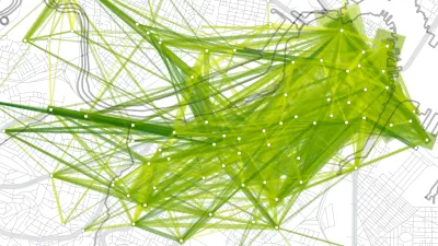
A Better Way to Compare Cities
An online tool released three weeks ago by the Chicago Federal Reserve allows a more nuanced comparison between peer cities.
An Online Portal for Making Sense of Toronto Traffic Data
With so many potential sources of data with which to analyze traffic behaviors and real-time conditions, University of Toronto engineers have created an online portal that could one day help drive a system populated with autonomous cars.

National Parks Layoffs Will Cause Communities to Lose Billions
Thousands of essential park workers were laid off this week, just before the busy spring break season.

Retro-silient?: America’s First “Eco-burb,” The Woodlands Turns 50
A master-planned community north of Houston offers lessons on green infrastructure and resilient design, but falls short of its founder’s lofty affordability and walkability goals.

Delivering for America Plan Will Downgrade Mail Service in at Least 49.5 Percent of Zip Codes
Republican and Democrat lawmakers criticize the plan for its disproportionate negative impact on rural communities.

Test News Post 1
This is a summary

Test News Headline 46
Test for the image on the front page.

Balancing Bombs and Butterflies: How the National Guard Protects a Rare Species
The National Guard at Fort Indiantown Gap uses GIS technology and land management strategies to balance military training with conservation efforts, ensuring the survival of the rare eastern regal fritillary butterfly.
Urban Design for Planners 1: Software Tools
This six-course series explores essential urban design concepts using open source software and equips planners with the tools they need to participate fully in the urban design process.
Planning for Universal Design
Learn the tools for implementing Universal Design in planning regulations.
EMC Planning Group, Inc.
Planetizen
Planetizen
Mpact (formerly Rail~Volution)
Great Falls Development Authority, Inc.
HUDs Office of Policy Development and Research
NYU Wagner Graduate School of Public Service