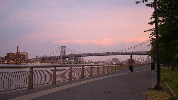
This week Manhattan borough president Scott M. Stringer was set to outline a blueprint for expanding access to the East River in his state of the borough speech. In the aftermath of Hurricane Sandy, the improvements are seen as a potential buffer.
Lisa W. Foderaro discusses the East River Blueway Plan, the culmination of a 14-month community-based planning process that sought to reconnect residents with the riverfront.
"The plan will not be officially released for a few weeks, but a copy was obtained by The New York Times in advance of the speech. Among the major recommendations are the development of a new public beach and kayak launch directly beneath the Brooklyn Bridge, where a naturally occurring sand beach forms a rock-strewn crescent that is now fenced off; the creation of two boat launches at Stuyvesant Cove at the ends of 20th and 23rd Streets; the installation of marshlands and sea walls in especially vulnerable flood zones, and the planting of trees and greenery all along the F.D.R. Drive to provide shade and absorb storm water runoff."
“We want very much to open the waterfront from a recreation perspective, but we also want to protect our fragile waterfront from Mother Nature by recognizing the reality of storm surges,” Mr. Stringer said in a phone interview. “What’s novel here is that we actually remedy some of the issues with storm surges through amenity enhancements for the public.”
"The plan builds on a decade of activity along the East River," explains Foderaro, "from newly opened piers to park renovations, as well as on earlier city studies, notably the City Planning Department’s 'Vision 2020: New York City Comprehensive Waterfront Plan' and the Economic Development Corporation’s 'Transforming the East River Waterfront.' [PDF]”
"While the 14-month planning process had already addressed climate change, Hurricane Sandy led to deeper discussions with experts on approaches to flooding in places like Venice and the Netherlands. 'We now know that this area was the Achilles’ heel of the storm surge,' Mr. Stringer said. 'We have got to make the case to the federal government and state government that if we are going to continue to build our waterfront, we can’t build the way we used to.'”
FULL STORY: A Plan Aims to Reconnect Residents With the East River Waterfront

National Parks Layoffs Will Cause Communities to Lose Billions
Thousands of essential park workers were laid off this week, just before the busy spring break season.

Retro-silient?: America’s First “Eco-burb,” The Woodlands Turns 50
A master-planned community north of Houston offers lessons on green infrastructure and resilient design, but falls short of its founder’s lofty affordability and walkability goals.

Delivering for America Plan Will Downgrade Mail Service in at Least 49.5 Percent of Zip Codes
Republican and Democrat lawmakers criticize the plan for its disproportionate negative impact on rural communities.

Test News Post 1
This is a summary

Test News Headline 46
Test for the image on the front page.

Balancing Bombs and Butterflies: How the National Guard Protects a Rare Species
The National Guard at Fort Indiantown Gap uses GIS technology and land management strategies to balance military training with conservation efforts, ensuring the survival of the rare eastern regal fritillary butterfly.
Urban Design for Planners 1: Software Tools
This six-course series explores essential urban design concepts using open source software and equips planners with the tools they need to participate fully in the urban design process.
Planning for Universal Design
Learn the tools for implementing Universal Design in planning regulations.
EMC Planning Group, Inc.
Planetizen
Planetizen
Mpact (formerly Rail~Volution)
Great Falls Development Authority, Inc.
HUDs Office of Policy Development and Research
NYU Wagner Graduate School of Public Service


