


Planners in the city of San Francisco have a proposed a $1.4 million study to examine the possibility of removing part of Interstate 280 in the city and convert a rail yard would yield 37 acres of prime urban real estate.
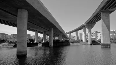
A new $1.4 million study would examine the benefits, and financial realities of removing part of a freeway and converting an existing rail yard into a “high quality urban environment,” if approved by the city and county of San Francisco.
“[The study] will look for the best way to transform the three-block-long rail yard into a new urban neighborhood before building the downtown rail extension that will bring Caltrain to the new Transbay Transit Center, the planned electrification of Caltrain and the opening of still-uncertain high-speed rail system, which would also go to the transit center,” reports John Wildermuth.
The proposed study follows “[a] preliminary and much-less-detailed study in 2012 of the area suggested that land freed up by moving the rail yard and converting the freeway into a surface-level boulevard at 16th Street near Mariposa Street.” The conclusion of that idea: “[the land] could be sold to developers for up to $228 million, an estimate the study described as conservative.”
FULL STORY: Study to look at demolishing I-280, moving train yard

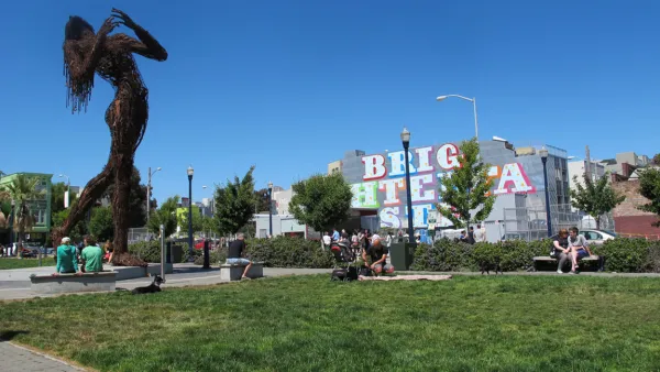
San Francisco: Model for Freeway Removal
Architecture critic John King tagged along with the Congress for New Urbanism. The latter was recently in San Francisco to examine the benefits of freeway removal. The city's prime case study: Octavia Boulevard.
San Francisco Debates Tearing Down More Freeways
One of the cities that's led the growing trend in urban freeway removal is considering another tear down, report Phillip Matier and Andrew Ross.
When Removing a Freeway Becomes Mundane
As a growing number of communities study freeway removal, what if the decision was no longer controversial? In Long Beach, California, two city-owned freeways carry less traffic than some neighborhood streets. Would anyone notice if they were gone?

National Parks Layoffs Will Cause Communities to Lose Billions
Thousands of essential park workers were laid off this week, just before the busy spring break season.

Retro-silient?: America’s First “Eco-burb,” The Woodlands Turns 50
A master-planned community north of Houston offers lessons on green infrastructure and resilient design, but falls short of its founder’s lofty affordability and walkability goals.

Delivering for America Plan Will Downgrade Mail Service in at Least 49.5 Percent of Zip Codes
Republican and Democrat lawmakers criticize the plan for its disproportionate negative impact on rural communities.

Test News Post 1
This is a summary

Test News Headline 46
Test for the image on the front page.

Balancing Bombs and Butterflies: How the National Guard Protects a Rare Species
The National Guard at Fort Indiantown Gap uses GIS technology and land management strategies to balance military training with conservation efforts, ensuring the survival of the rare eastern regal fritillary butterfly.
Urban Design for Planners 1: Software Tools
This six-course series explores essential urban design concepts using open source software and equips planners with the tools they need to participate fully in the urban design process.
Planning for Universal Design
Learn the tools for implementing Universal Design in planning regulations.
EMC Planning Group, Inc.
Planetizen
Planetizen
Mpact (formerly Rail~Volution)
Great Falls Development Authority, Inc.
HUDs Office of Policy Development and Research
NYU Wagner Graduate School of Public Service