


The "Accidental Skyline" project puts a powerful visualization tool in the hands of citizens curious to know more about the possible development enabled by the land use regulations of New York City.
Matt Shaw shares news of the Accidental Skyline project, which is "a set of online maps that illustrate where possible development could occur in Gotham. The maps…allow citizens to track land that has available development rights and see how it could impact their neighborhood."
"The maps highlight the impacts of development on parks, open space, infrastructure, and skyline, and were made possible by the Department of City Planning’s public release of MapPLUTO data last year. They've been updated to include transportation routes, parks, and New York Housing Authority land overlays to present a more comprehensive picture of planning issues."
The project is the work of the Municipal Art Society, which created the maps as a tool "to work with the city to make regulatory changes that will better protect iconic public spaces."
FULL STORY: This App Maps the Unseen Skyline of NYC


Miss the Subway? There's an App for That
The NYC Subway Sounds app is a great tool for dealing with nostalgia for the old ways of life.
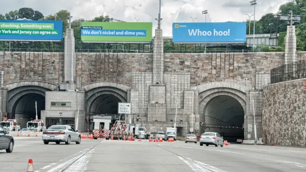
Waze Outfits NYC Tunnels with Beacons for Underground Navigation
The tech is part of a public-private partnership meant to improve connectivity to Waze and other navigation apps from underground.

A New York City Planner’s Long and Influential History
A look back at Purnima Kapur’s career highlights the long-term impacts of her planning work.

National Parks Layoffs Will Cause Communities to Lose Billions
Thousands of essential park workers were laid off this week, just before the busy spring break season.

Retro-silient?: America’s First “Eco-burb,” The Woodlands Turns 50
A master-planned community north of Houston offers lessons on green infrastructure and resilient design, but falls short of its founder’s lofty affordability and walkability goals.

Delivering for America Plan Will Downgrade Mail Service in at Least 49.5 Percent of Zip Codes
Republican and Democrat lawmakers criticize the plan for its disproportionate negative impact on rural communities.

Test News Post 1
This is a summary

Test News Headline 46
Test for the image on the front page.

Balancing Bombs and Butterflies: How the National Guard Protects a Rare Species
The National Guard at Fort Indiantown Gap uses GIS technology and land management strategies to balance military training with conservation efforts, ensuring the survival of the rare eastern regal fritillary butterfly.
Urban Design for Planners 1: Software Tools
This six-course series explores essential urban design concepts using open source software and equips planners with the tools they need to participate fully in the urban design process.
Planning for Universal Design
Learn the tools for implementing Universal Design in planning regulations.
EMC Planning Group, Inc.
Planetizen
Planetizen
Mpact (formerly Rail~Volution)
Great Falls Development Authority, Inc.
HUDs Office of Policy Development and Research
NYU Wagner Graduate School of Public Service