


"A new report out of Rutgers University reveals that since 2010, the fringes of the New York region have lost population as the core has grown," according to an article by Stephen Miller.
Stephen Miller shares news of a study, "The Receding Metropolitan Perimeter," [pdf] out of Rutgers University. After comparing regional growth between 1950 and 1980 to the most recent available data, which covers 2010 to 2013, study authors (James W. Hughes and Joseph J. Seneca of the Edward J. Bloustein School of Planning and Public Policy) "say recent shifts may signal the beginning of a long-term change toward more compact growth, while acknowledging that it’s too early to conclusively say so."
Trends since 2000 have nearly reversed the three-decades of growth between 1950 and 1980: "Suburban counties kept growing, but at barely a fifth of the annual rate seen in earlier decades. The highest growth rates were in inner ring locations like Bergen, Westchester, and Fairfield counties. In contrast, there were actual population losses in nearly half of the suburban counties, almost entirely on the fringe of the region, including Putnam, Dutchess, Sullivan, and Ulster counties in New York, and Sussex, Warren, and Hunterdon counties in New Jersey."
FULL STORY: Peak Sprawl? The Fringes of the New York Region Are Shrinking

Florida Law Would Change the Definition of ‘Sprawl’
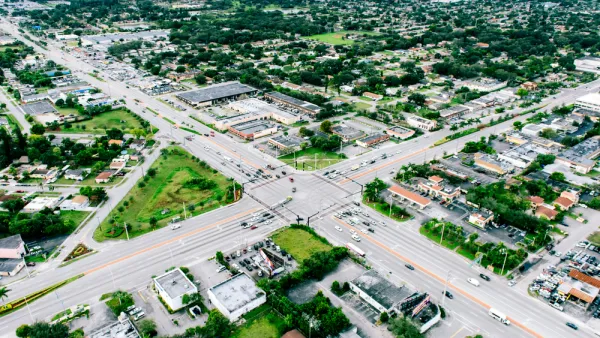
One quick way to build sprawl.

The Pandemic Population Picture Comes Into Focus
Big U.S. cities lost population as the pandemic loitered into its second year. Suburban cities in Idaho, Arizona, Texas, and Florida grew the fastest during that time.

Different Approaches to Fast Growth in Idaho's Treasure Valley
Three cities on the periphery of the fast-growing Treasure Valley showcase different approaches to a sudden influx of newcomers.

National Parks Layoffs Will Cause Communities to Lose Billions
Thousands of essential park workers were laid off this week, just before the busy spring break season.

Retro-silient?: America’s First “Eco-burb,” The Woodlands Turns 50
A master-planned community north of Houston offers lessons on green infrastructure and resilient design, but falls short of its founder’s lofty affordability and walkability goals.

Delivering for America Plan Will Downgrade Mail Service in at Least 49.5 Percent of Zip Codes
Republican and Democrat lawmakers criticize the plan for its disproportionate negative impact on rural communities.

Test News Post 1
This is a summary

Test News Headline 46
Test for the image on the front page.

Balancing Bombs and Butterflies: How the National Guard Protects a Rare Species
The National Guard at Fort Indiantown Gap uses GIS technology and land management strategies to balance military training with conservation efforts, ensuring the survival of the rare eastern regal fritillary butterfly.
Urban Design for Planners 1: Software Tools
This six-course series explores essential urban design concepts using open source software and equips planners with the tools they need to participate fully in the urban design process.
Planning for Universal Design
Learn the tools for implementing Universal Design in planning regulations.
EMC Planning Group, Inc.
Planetizen
Planetizen
Mpact (formerly Rail~Volution)
Great Falls Development Authority, Inc.
HUDs Office of Policy Development and Research
NYU Wagner Graduate School of Public Service