


A blighted abandoned rail corridor through South Los Angeles received funding to plan a rail to trail conversion. Can residents compel officials to complete the sorely needed open space facility?
The Los Angeles County Metropolitan Transportation Authority recently "approved $2.8 million to plan a 'rail-to-river' path along Slauson Avenue from the Los Angeles River to the Crenshaw Metro line — one of the most blighted parts of the city." The project, reports Andrea Gardner, would "transform eight miles of abandoned roadway into a bike and pedestrian path" at an estimated cost of $35 million.
The article (which also includes an audio version from its radio broadcast) also focuses on the neighborhood and residents who would benefit by the conversion. "Residents told the board the project was needed in a community known for high obesity and a low rate of car ownership. Many noted that South Los Angeles is also 'park poor,' with less than 2 acres of park space for every 1,000 residents. By comparion [sic], West Los Angeles has more than 50 acres of park space for every 1,000 residents."
FULL STORY: South Los Angeles residents push to transform railway to 8-mile greenbelt

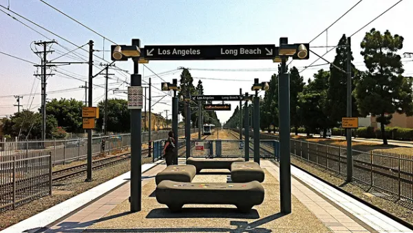
L.A. Metro Will Spend $81.5 Million to Improve Blue Line to Long Beach
The Los Angeles County Metropolitan Transportation Authority (Metro) appears to be taking a break from its perpetual expansion projects to make some improvements to the heavily used but aging Blue Line.

Improving South Los Angeles Through Strategic Tree Planting
The University of Southern California Urban Trees Initiative is planting 250 trees in South L.A. neighborhoods to improve shade, combat climate change, and enhance community well-being through collaboration and data-driven approaches.

Addressing Tree Canopy Disparity in South Los Angeles
A new study highlights the complex challenge of addressing tree canopy disparities in South L.A., where historical environmental injustices, budget constraints, and competing community priorities hinder efforts to increase equitable tree coverage.

National Parks Layoffs Will Cause Communities to Lose Billions
Thousands of essential park workers were laid off this week, just before the busy spring break season.

Retro-silient?: America’s First “Eco-burb,” The Woodlands Turns 50
A master-planned community north of Houston offers lessons on green infrastructure and resilient design, but falls short of its founder’s lofty affordability and walkability goals.

Delivering for America Plan Will Downgrade Mail Service in at Least 49.5 Percent of Zip Codes
Republican and Democrat lawmakers criticize the plan for its disproportionate negative impact on rural communities.

Test News Post 1
This is a summary

Test News Headline 46
Test for the image on the front page.

Balancing Bombs and Butterflies: How the National Guard Protects a Rare Species
The National Guard at Fort Indiantown Gap uses GIS technology and land management strategies to balance military training with conservation efforts, ensuring the survival of the rare eastern regal fritillary butterfly.
Urban Design for Planners 1: Software Tools
This six-course series explores essential urban design concepts using open source software and equips planners with the tools they need to participate fully in the urban design process.
Planning for Universal Design
Learn the tools for implementing Universal Design in planning regulations.
EMC Planning Group, Inc.
Planetizen
Planetizen
Mpact (formerly Rail~Volution)
Great Falls Development Authority, Inc.
HUDs Office of Policy Development and Research
NYU Wagner Graduate School of Public Service