


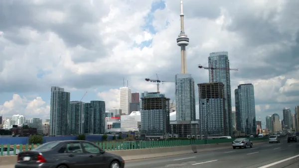
A recently released report makes the case for removing, in part or in full, an elevated span of roadway along the Toronto Waterfront.
David Rider reports on the recently released environmental assessment (EA) released by Waterfront Toronto, a public organization tasked with revitalizing Toronto waterfront, that recommends removing part of all of the Gardiner Expressway.
The EA considers options for full or partial (called a "hybrid" plan by the report) removal of the elevated span. Full removal would entail "[r]emoving the entire 2.4 kilometre expressway east of Jarvis St., and replacing the stretch to the Don Valley Parkway with an eight-lane, street-level boulevard," according to Rider. The hybrid plan would "[leave] the elevated Gardiner in place between Jarvis and the Don River, and replace the ramp between the Don and Logan Ave. with a six-lane boulevard."
Rider lists out the benefits of each plan, as stated in the EA, and also notes that the cost of simply maintaining the span as it is would require $864 million over the next 100 years. The article includes "swipe" frames of renderings used to compare each of the two options.
FULL STORY: All or part of the eastern Gardiner should be removed, study says

Toronto City Council Decides to Rebuild Gardiner East Expressway
Coulda, woulda, shoulda. The Toronto City Council sided with Mayor John Tory this week to rebuild an elevated freeway in downtown rather than tearing it down.
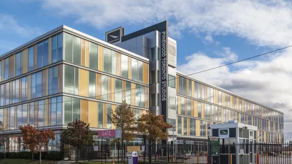
Are Movie Studios 'Highest and Best Use' During a Housing Affordability Crisis?
Toronto's answer to the question posed in the headline is, "yes." One columnist wonders if the city can do more to balance its priorities.

Proposed Toronto Highways Raise Environmental Concerns
Opponents of two new planned highways in greater Toronto argue the construction of new roads is 'short-sighted at best' and would threaten the region's greenbelt areas.

National Parks Layoffs Will Cause Communities to Lose Billions
Thousands of essential park workers were laid off this week, just before the busy spring break season.

Retro-silient?: America’s First “Eco-burb,” The Woodlands Turns 50
A master-planned community north of Houston offers lessons on green infrastructure and resilient design, but falls short of its founder’s lofty affordability and walkability goals.

Delivering for America Plan Will Downgrade Mail Service in at Least 49.5 Percent of Zip Codes
Republican and Democrat lawmakers criticize the plan for its disproportionate negative impact on rural communities.

Test News Post 1
This is a summary

Test News Headline 46
Test for the image on the front page.

Balancing Bombs and Butterflies: How the National Guard Protects a Rare Species
The National Guard at Fort Indiantown Gap uses GIS technology and land management strategies to balance military training with conservation efforts, ensuring the survival of the rare eastern regal fritillary butterfly.
Urban Design for Planners 1: Software Tools
This six-course series explores essential urban design concepts using open source software and equips planners with the tools they need to participate fully in the urban design process.
Planning for Universal Design
Learn the tools for implementing Universal Design in planning regulations.
EMC Planning Group, Inc.
Planetizen
Planetizen
Mpact (formerly Rail~Volution)
Great Falls Development Authority, Inc.
HUDs Office of Policy Development and Research
NYU Wagner Graduate School of Public Service