


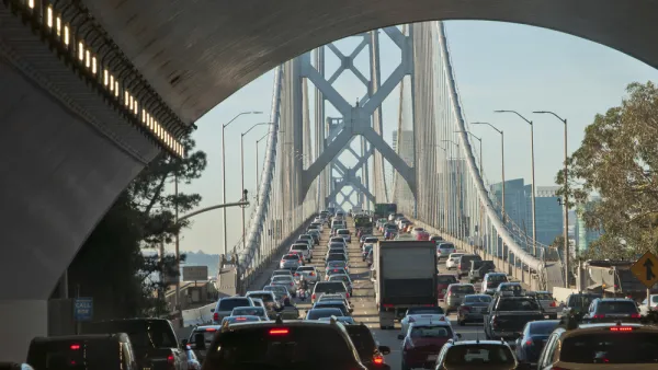
One of the nation's busiest commute corridors will get a lot busier in coming decades with no large infrastructure investment in sight. SPUR has some ideas about how the East Bay to San Francisco corridor can be improved right now.
Dylan Pilaar, Erin McAuliff, and Ratna Amin report on the state, and possible future, of the Bay Area's highest-volume commute: the Bay crossing between San Francisco and the East Bay. Despite increased demand in recent years, no new transportation capacity has been added to the route since 1972. Meanwhile, transbay trips are expected to grow by 70 percent between 2015 and 2035.
"Consensus is brewing that a new transbay rail line is needed to solve the problem. A big-picture vision for a second transbay BART tube (which SPUR called for in a 2009 Report), has gained traction in recent months. A second transbay rail tube — be it for BART, standard rail like Caltrain or Amtrak, high-speed rail or a combination of the three — is essential to solving the Bay Area’s transit capacity crunch."
Such solutions, however, are likely to take decades to plan and deliver, and will not help relieve transportation crunches in the meantime. The article, written by the trio for SPUR on the Medium website, focuses on what can be done while the region works toward next big transportation investments. For a start:
"The new San Francisco Bay Area Core Capacity Transit Study, which kicks off this year, will identify short-, medium- and long-term improvements in the transbay travel corridor. The study — which involves the Metropolitan Transportation Commission, the San Francisco Municipal Transportation Agency, the San Francisco County Transportation Agency, BART, AC Transit, the Water Emergency Transportation Agency and Caltrain — will paint a clear picture of commuter travel patterns and determine how best to address the needs of Bay Area commuters."
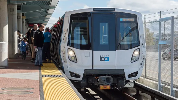
SPUR also recommends additional measures while that study is underway, including maximizing capacity and efficiency on the BART system, adding bus lanes on the Bay Bridge and its highway approaches, deploying new demand pricing models to provide incentives for alternative modes, and several more recommendations.
FULL STORY: How Can We Move More People Between SF and the East Bay?

$100 Billion Bay Area Transportation Tax Considered for November 2020 Ballot
Two years after voters in the nine-county Bay Area agreed to hike tolls on the region's seven state-owned bridges, regional business leaders are hoping they will approve a one-cent regional sales tax to fund $100 billion in transportation projects.
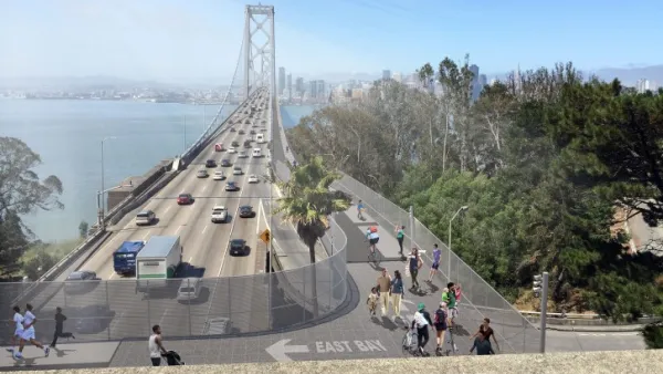
Planning Underway for New Bay Bridge Bike Path, and a Second Transbay BART Tube
In a distant and expensive future, there are two new ways to get across the San Francisco Bay without a car. One will have a much better view.
Bay Area's Transbay Dilemma: Second BART Tube or Second Bay Bridge?
In December, Sen. Dianne Feinstein reactivated her call for a southern crossing over the Bay while the BART Board last week began studying a second Transbay tube. The San Francisco Chronicle editorial board opines on which is preferable.

National Parks Layoffs Will Cause Communities to Lose Billions
Thousands of essential park workers were laid off this week, just before the busy spring break season.

Retro-silient?: America’s First “Eco-burb,” The Woodlands Turns 50
A master-planned community north of Houston offers lessons on green infrastructure and resilient design, but falls short of its founder’s lofty affordability and walkability goals.

Delivering for America Plan Will Downgrade Mail Service in at Least 49.5 Percent of Zip Codes
Republican and Democrat lawmakers criticize the plan for its disproportionate negative impact on rural communities.

Test News Post 1
This is a summary

Test News Headline 46
Test for the image on the front page.

Balancing Bombs and Butterflies: How the National Guard Protects a Rare Species
The National Guard at Fort Indiantown Gap uses GIS technology and land management strategies to balance military training with conservation efforts, ensuring the survival of the rare eastern regal fritillary butterfly.
Urban Design for Planners 1: Software Tools
This six-course series explores essential urban design concepts using open source software and equips planners with the tools they need to participate fully in the urban design process.
Planning for Universal Design
Learn the tools for implementing Universal Design in planning regulations.
EMC Planning Group, Inc.
Planetizen
Planetizen
Mpact (formerly Rail~Volution)
Great Falls Development Authority, Inc.
HUDs Office of Policy Development and Research
NYU Wagner Graduate School of Public Service