


Cartographers have a new world to map, as technology opens up the interiors of malls, museums, and other large spaces to online exploration.
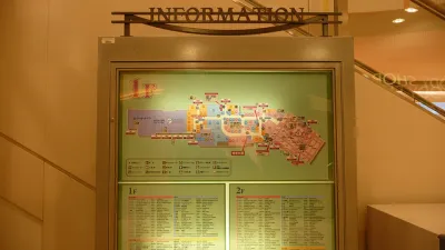
CityMetric reports on the efforts by Google to start mapping the interior of buildings, which presents a whole new area of exploration for cartographers. Sending people into large venues wearing a rucksack contraption, Google is able to map the interior of spaces such as the British Museum in London, allowing viewers to move from the museum’s basement level to the fifth floor to find the location of specific exhibits.
Google has used the rucksack to build up a growing list of indoor maps... Most are large indoor venues, museums or shopping centres – places which often offer their own floorplan maps thanks to their size and the number of services on offer. It makes sense that these maps would eventually transfer to the digital arena, just as outdoor maps have.
Apple appears to be getting into the indoor mapping space as well, launching the “Indoor Survey App”, which CityMetric notes is accessible only through a direct link to the app’s page. “According to the app description, it allows users to map indoor spaces by ‘dropping points’.”
Moving beyond the 2D limitations of Google and Apple Maps, Harvard University is partnering with the Redlands, California-based SmarterBetterCiities to create 3D interior maps of the Harvard campus. SmarterBetterCities uses ESRI’s ArcGIS platform to create 3D models of interior spaces, such as a map prepared for the ESRI User Conference in the San Diego Convention Center, viewable here.
FULL STORY: Why the indoors could be the next frontier for map-makers


Friday Funny: Cartographers Are Hiding an Idyllic Continent
The rest of the world would only spoil it for the mapmakers.
Friday Eye Candy: Charting Road Maps By Hand
In the days before Google Maps, when AAA TripTiks and Thomas Guides ruled the planet…

Friday Eye Candy: Highly Detailed Cold War Era Soviet Maps of the U.S.
A new book sheds light on maps created by cartographers in the Soviet Union that dove into remarkable detail about buildings, transportation networks, and other infrastructure in cities across the United States and around the world.

National Parks Layoffs Will Cause Communities to Lose Billions
Thousands of essential park workers were laid off this week, just before the busy spring break season.

Retro-silient?: America’s First “Eco-burb,” The Woodlands Turns 50
A master-planned community north of Houston offers lessons on green infrastructure and resilient design, but falls short of its founder’s lofty affordability and walkability goals.

Delivering for America Plan Will Downgrade Mail Service in at Least 49.5 Percent of Zip Codes
Republican and Democrat lawmakers criticize the plan for its disproportionate negative impact on rural communities.

Test News Post 1
This is a summary

Test News Headline 46
Test for the image on the front page.

Balancing Bombs and Butterflies: How the National Guard Protects a Rare Species
The National Guard at Fort Indiantown Gap uses GIS technology and land management strategies to balance military training with conservation efforts, ensuring the survival of the rare eastern regal fritillary butterfly.
Urban Design for Planners 1: Software Tools
This six-course series explores essential urban design concepts using open source software and equips planners with the tools they need to participate fully in the urban design process.
Planning for Universal Design
Learn the tools for implementing Universal Design in planning regulations.
EMC Planning Group, Inc.
Planetizen
Planetizen
Mpact (formerly Rail~Volution)
Great Falls Development Authority, Inc.
HUDs Office of Policy Development and Research
NYU Wagner Graduate School of Public Service