


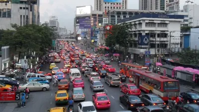
Determining whether to widen a street solely based on rush hour traffic ignores how the street is used and who uses it the rest of the day.
Writing in Streets.mn, Bill Lindeke challenges current practices in planning that place too much emphasis on Level of Service (LOS) and rush hour traffic in determining how we build out our roads. Using examples from Saint Paul, Lindeke notes that the increase in vehicle movement through intersection is great for the few hours of rush hour traffic, and barely noticeable at all other times of the day. And that newly widened road really isn’t doing any favors for moving pedestrians around.
If you combine the two “peak hours” (giving them 2-hour time slots), you end up with 4 hours of the 24-hour day. That leaves 20-hours of the day that are “off peak”, times when the road will be “overbuilt” for the amount of traffic that it has.
Basically, transportation planners are always faced with a choice here: Do you give design priority to the people using the street for those 4 hours of the day at the expense of the people that “use” the street for the other 20 hours?
Lindeke suggests a move toward using a multi-modal LOS "that balanced LOS for cars against LOS for other modes of mobility" (i.e., pedestrians, cars, bicycles, buses). Another option would be to simply expand the hours by which we measure LOS to get a better understanding of how the roadway is used throughout the day, and planning for all users, rather than just the few that clog the intersections during rush hour.
FULL STORY: The Injustice of Peak Hour Myopia


Shifting the Focus for Transportation Planning in Fairfax County
Fairfax County wants to move away from a heavy reliance on level of service in favor of more pedestrian- and transit-oriented planning.
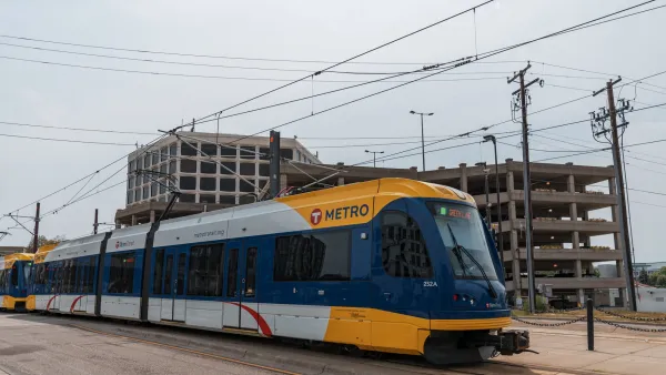
Two Years In, a Look at the Twin Cities Fare Discount Program
In 2017, Metro Transit in the Twin Cities raised fares but also started a program for low-income riders to help ease the burden of travel costs.

Level of Service, the Wrong Performance Measure
The use of level of service (LOS) to gauge the success of roadway networks has shaped and influenced cities in many negative ways.

National Parks Layoffs Will Cause Communities to Lose Billions
Thousands of essential park workers were laid off this week, just before the busy spring break season.

Retro-silient?: America’s First “Eco-burb,” The Woodlands Turns 50
A master-planned community north of Houston offers lessons on green infrastructure and resilient design, but falls short of its founder’s lofty affordability and walkability goals.

Delivering for America Plan Will Downgrade Mail Service in at Least 49.5 Percent of Zip Codes
Republican and Democrat lawmakers criticize the plan for its disproportionate negative impact on rural communities.

Test News Post 1
This is a summary

Test News Headline 46
Test for the image on the front page.

Balancing Bombs and Butterflies: How the National Guard Protects a Rare Species
The National Guard at Fort Indiantown Gap uses GIS technology and land management strategies to balance military training with conservation efforts, ensuring the survival of the rare eastern regal fritillary butterfly.
Urban Design for Planners 1: Software Tools
This six-course series explores essential urban design concepts using open source software and equips planners with the tools they need to participate fully in the urban design process.
Planning for Universal Design
Learn the tools for implementing Universal Design in planning regulations.
EMC Planning Group, Inc.
Planetizen
Planetizen
Mpact (formerly Rail~Volution)
Great Falls Development Authority, Inc.
HUDs Office of Policy Development and Research
NYU Wagner Graduate School of Public Service