


A mapping project lead by Facebook's Connectivity Lab is gathering data from all over the atmosphere, and beyond, to make a comprehensive map of the world's buildings.
Tara Golsham shares news about a big data project underway at Facebook with tongue in cheek: "Facebook is making a map of every human-occupied building on Earth so that one day, people in the most remote areas of the world can also worry about what to do when their mom friends them on Facebook."
The mapping project is the work of Facebook's Connectivity Lab, "a group tasked with using drones, satellites, and lasers to improve internet access in developing countries," according to Golsham. For the mapping project, Connectivity Lab "has analyzed 21.6 million square kilometers' worth of satellite imagery — about 350 terabytes of data" to develop a much clearer picture of where buildings and structures are located in remote parts of world. That information is the first step in delivering Internet services to those remote areas.
The Connectivity Lab team has also created a post explaining the technical details of the mapping project.
FULL STORY: Why Facebook is making a map of every building in the world

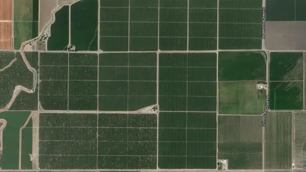
Facebook AI Maps Population Density
Facebook expects to release its worldwide maps of human density in the coming months—potential applications will likely be somewhere on the spectrum between humanitarian and commercial.

How the National Park Service Uses GIS
A new book demonstrates how the National Park Service uses GIS technology to meet its mission and showcases a selection of maps used for effectively managing national parks.
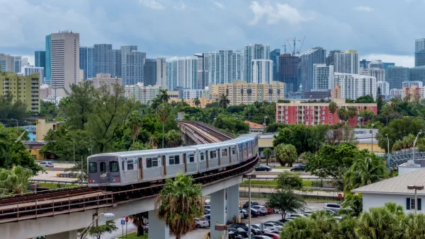
New Tool Puts Miami Development Opportunities on the Map
There's plenty of vacant or underutilized land to be found in Miami-Dade County, if you know where and how to look.

Analysis: Cybertruck Fatality Rate Far Exceeds That of Ford Pinto
The Tesla Cybertruck was recalled seven times last year.

National Parks Layoffs Will Cause Communities to Lose Billions
Thousands of essential park workers were laid off this week, just before the busy spring break season.

Retro-silient?: America’s First “Eco-burb,” The Woodlands Turns 50
A master-planned community north of Houston offers lessons on green infrastructure and resilient design, but falls short of its founder’s lofty affordability and walkability goals.

Test News Post 1
This is a summary

Analysis: Cybertruck Fatality Rate Far Exceeds That of Ford Pinto
The Tesla Cybertruck was recalled seven times last year.

Test News Headline 46
Test for the image on the front page.
Urban Design for Planners 1: Software Tools
This six-course series explores essential urban design concepts using open source software and equips planners with the tools they need to participate fully in the urban design process.
Planning for Universal Design
Learn the tools for implementing Universal Design in planning regulations.
EMC Planning Group, Inc.
Planetizen
Planetizen
Mpact (formerly Rail~Volution)
Great Falls Development Authority, Inc.
HUDs Office of Policy Development and Research
NYU Wagner Graduate School of Public Service