


A new crowdsourced map projects asks people to draw their city limits from memory.
Tanvi Misra shares news of the new mapping project by Alasdair Rae, an urban scholar at the University of Sheffield, U.K., who is crowdsourcing maps of the mental boundaries of cities.
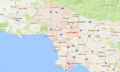
Rae's own words describe this project:
Sometimes official city boundaries extend far beyond the urban fabric, and sometimes they don't include very much of it at all. I want to see what people consider to be part of their city, or not. All the drawn boundaries on this site come from your contributions.
Yes, you can draw your own map, and, yes, you can view previous mapping attempts.
Misra notes two takeaways. First, "[f]or many, the paths they take to move around the city become its de-facto borders. M25, the highway that circles London’s core, for example, is a popular option."
Second, the "map confirms what we’ve known for a while—that how our mind recalls the space around us depends heavily on the landmarks and routes that we know and take."
FULL STORY: Where Are Your City Limits?


The Gig Economy for Mapping
A new startup wants to use blockchain and the Uber model to create free, open-source maps.
CicLAvia Tour Integrates Crowdsourcing
As cyclists toured Watts and other parts of South Los Angeles, they were invited to share photographs and record places of interest along the way.
Top 10 Free Web Applications for Planning
I had the opportuntity, at the 2009 national planning conference in Minneapolis, to present (together with my colleague Christian Peralta Madera) ten free web applications that can be used to support planning. Approximately 350 participants attended the session. Since the presentation, I've received over 100 emails congratulating us on the practical nature of the presentation, and requesting links to the websites we presented. Since our presentation was a hands-on demonstration, this blog entry outlines the ten technologies, and provides links to examples of the technology in practice and resources so you can experiment with the technologies.

National Parks Layoffs Will Cause Communities to Lose Billions
Thousands of essential park workers were laid off this week, just before the busy spring break season.

Retro-silient?: America’s First “Eco-burb,” The Woodlands Turns 50
A master-planned community north of Houston offers lessons on green infrastructure and resilient design, but falls short of its founder’s lofty affordability and walkability goals.

Delivering for America Plan Will Downgrade Mail Service in at Least 49.5 Percent of Zip Codes
Republican and Democrat lawmakers criticize the plan for its disproportionate negative impact on rural communities.

Test News Post 1
This is a summary

Test News Headline 46
Test for the image on the front page.

Balancing Bombs and Butterflies: How the National Guard Protects a Rare Species
The National Guard at Fort Indiantown Gap uses GIS technology and land management strategies to balance military training with conservation efforts, ensuring the survival of the rare eastern regal fritillary butterfly.
Urban Design for Planners 1: Software Tools
This six-course series explores essential urban design concepts using open source software and equips planners with the tools they need to participate fully in the urban design process.
Planning for Universal Design
Learn the tools for implementing Universal Design in planning regulations.
EMC Planning Group, Inc.
Planetizen
Planetizen
Mpact (formerly Rail~Volution)
Great Falls Development Authority, Inc.
HUDs Office of Policy Development and Research
NYU Wagner Graduate School of Public Service