


Google Maps and other navigation and mapping apps have done a lot to inspire and educate people to make the most of their surroundings. New changes to the Google Maps app will add new functionality for those purposes.
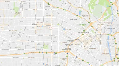
"Starting today we’re rolling out an update to Google Maps on Android that provides helpful everyday info––in real time––at the bottom of your home screen. Just swipe up and you’ll see three tabs that will help you find a nearby restaurant, beat traffic, or catch the next bus," according to a post by Mark Lowe, Google Maps product manager, on the Google blog.
More specifically, the tabs are called Places, Driving, and Transit. While the Places tabs provides new insight for people looking to explore the surrounding area, driving and transit will serve the more mundane moments of moving to and fro—especially during regular trips. Here's how Lowe describes the Transit tab:
With the transit tab, you’ll never have to sprint to the bus again. If you have your home and work addresses saved, you’ll see a recommendation for which bus or train to take, when the next one’s coming, and an ETA for when you’ll arrive at work or home. If you’re headed somewhere else, you can swipe down to find nearby transit stations along with real-time schedules.
In another recent Google Maps function update, Google introduced a new "parking difficulty icon" in Google Maps for Android that alerts users to parking crunches at their destination. That feature is available in 25 metropolitan areas in the United States.
FULL STORY: Get real-time commute info and more in one tap


New Google Map Layer Shows COVID-19 Infection Rates
A new layer showing the seven-day average of confirmed COVID-19 cases started rolling out to Android and iPhones last week.
Analyzing Lynch's City Imageability in the Digital Age
Mahbubur Meenar of Rowan University writes about a recent article he co-authored in the Journal of Planning Education and Research

Like Waze, But for Bikes
The mobile app LaneSpotter, described as a navigation app like Waze but for cyclists, has announced eight cities as the location for a pilot launch.

National Parks Layoffs Will Cause Communities to Lose Billions
Thousands of essential park workers were laid off this week, just before the busy spring break season.

Retro-silient?: America’s First “Eco-burb,” The Woodlands Turns 50
A master-planned community north of Houston offers lessons on green infrastructure and resilient design, but falls short of its founder’s lofty affordability and walkability goals.

Delivering for America Plan Will Downgrade Mail Service in at Least 49.5 Percent of Zip Codes
Republican and Democrat lawmakers criticize the plan for its disproportionate negative impact on rural communities.

Test News Post 1
This is a summary

Test News Headline 46
Test for the image on the front page.

Balancing Bombs and Butterflies: How the National Guard Protects a Rare Species
The National Guard at Fort Indiantown Gap uses GIS technology and land management strategies to balance military training with conservation efforts, ensuring the survival of the rare eastern regal fritillary butterfly.
Urban Design for Planners 1: Software Tools
This six-course series explores essential urban design concepts using open source software and equips planners with the tools they need to participate fully in the urban design process.
Planning for Universal Design
Learn the tools for implementing Universal Design in planning regulations.
EMC Planning Group, Inc.
Planetizen
Planetizen
Mpact (formerly Rail~Volution)
Great Falls Development Authority, Inc.
HUDs Office of Policy Development and Research
NYU Wagner Graduate School of Public Service